 Parking
- Linked to Public Transport
 Refreshments
- Dog Friendly
Things to look out for
Tick off the landmarks and points of interest you spot along this route as you go.


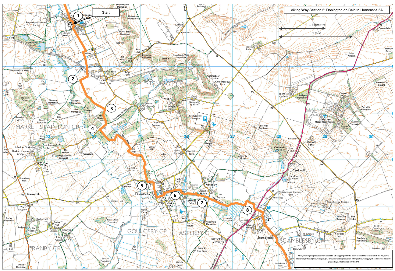
- 1Leave Donington on Bain via the public footpath opposite the church and next to the school. Follow the path along field edges for approx. 0.75 miles (1.2km) to reach a disused railway line. Cross the railway line and continue along the track for approx 300m.
- 2At a junction of tracks turn left, onto a permissive path, passing woods and crossing a field to reach a road.
- 3Turn right and follow the road for approx 550m.
- 4Turn left onto a public footpath. Cross the bridge and walk ahead to a fingerpost in the field and then bear left up the slope. At the top of the slope bear right to a gate and stile in the hedge ahead. Follow the track into Goulceby, passing the old cemetery of All Saints church, to a road.
- 5Turn left and then take the first right and the next left onto Butt Lane. After approx 200m turn right onto Shop Lane.
- 6At the T-junction carry straight on along the public footpath, across a field, through a wood and on beside a stream to a road.
- 7Turn right and then left to continue beside the stream. Follow the path beside the stream to a road (A153).
- 8Cross the road with care and continue along the footpath to a road and Scamblesby village. Turn right and at the junction turn left (signed Burwell). At the junction of Mill Lane and Chapel Lane continue straight on along Mill Lane (a no through road).
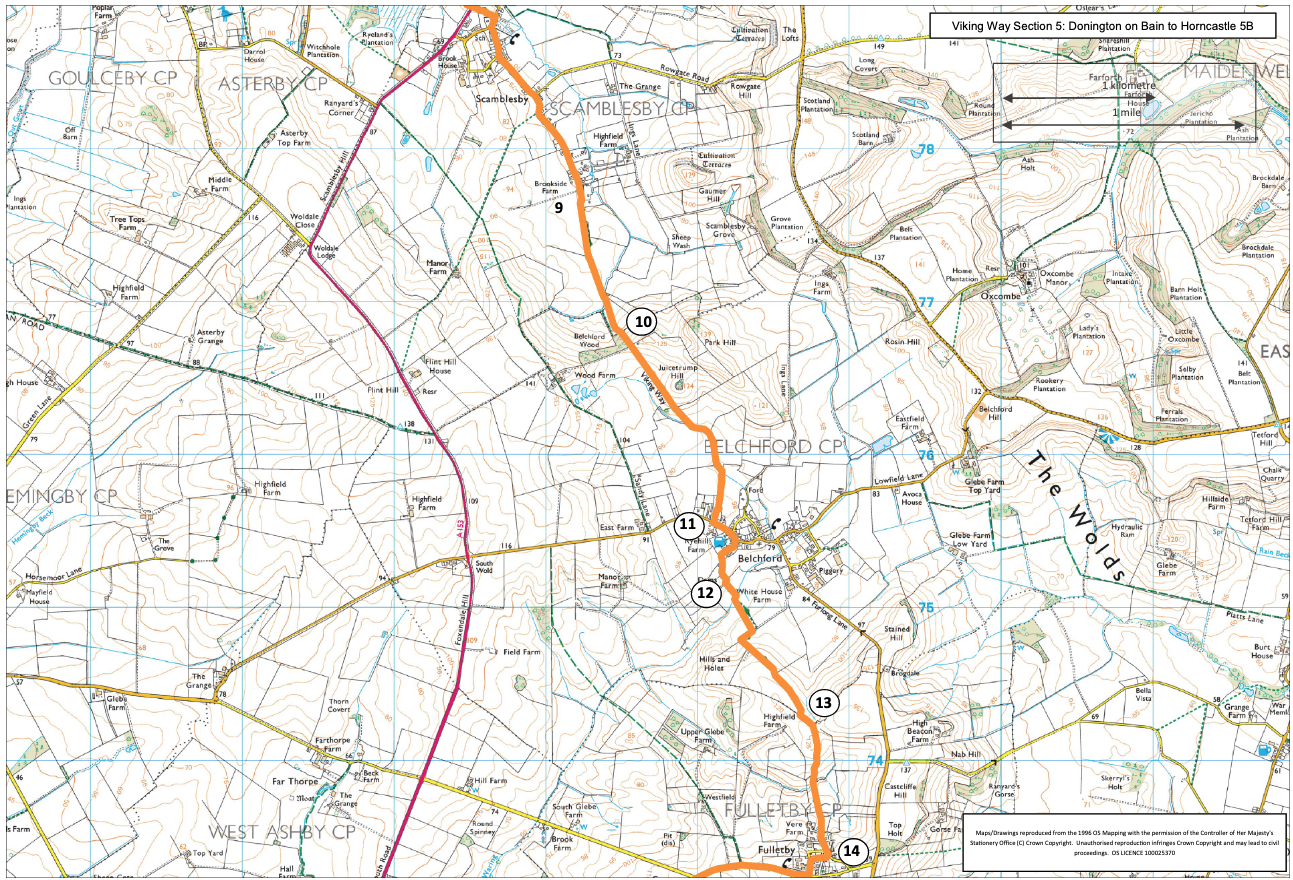
- 9At the end of the lane bear right onto a track and public footpath. Follow the track for approx. 0.5 miles (750m) to a gate. Cross the field to a gate at the left hand edge of the wood ahead.
- 10Continue ahead along the path, cross a track and continue ahead between two hedges. Cross a bridge on the right, turn left, and follow the path around field edge, across a paddock to a road and Belchford village.
- 11Turn left along the road into the village and turn right onto Dams Lane (just past the pub). Continue along the lane as it becomes a track.
- 12Turn left onto the public footpath. Cross a stream, turn right and follow the path around the field edge. At the top of the slope at a junction with a track, turn right and follow the track as it bends left and becomes a path along the edge of an arable field.
- 13At the top of the slope, and at the field corner, turn left and follow the path along the right hand side of the hedge and then across grass fields to a road and Fulletby village.
- 14Turn left and then take the third right, follow the road round to the left and at the T-junction turn right. Follow the road straight ahead for approx. 0.5 miles (750 m) to a junction with a no through road.
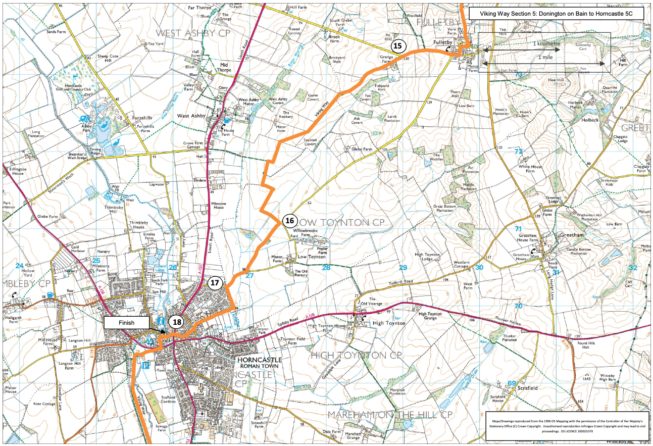
- 15Turn left and follow bridleway past a farm and along a track to a hedge. Follow the well signed field edge bridleway for approx two miles (3km) to a road.
- 16Turn right and follow the road towards Horncastle for approx 0.75 miles (1.2km) to the edge of the town.
- 17 Turn left onto a public footpath behind houses. At the road turn left and at the crossroads go straight over. At first T-junction turn left and at second turn right.
- 18At the crossroads continue straight ahead along High Street to the Market Square.