Walk
Loop
12.5miles
(20.12km)
6 hours

Walking

Spalding Leisure Wheel Walk Long

A walk around the attractive market town of Spalding in the heart of The Fens. The walk circles Spalding and gives an insight into the history and life of the town as it takes in its urban, rural and horticultural faces. Level walking it may be muddy and uneven in places.

Starting point
Springfields Outlet Shopping and Festival Gardens
Camelgate (just off the A16)
PE12 6EU
Grid reference: TF 263 240

  • ParkingParking
  • Linked to Public TransportLinked to Public Transport
  • RefreshmentsRefreshments
  • Dog FriendlyDog Friendly

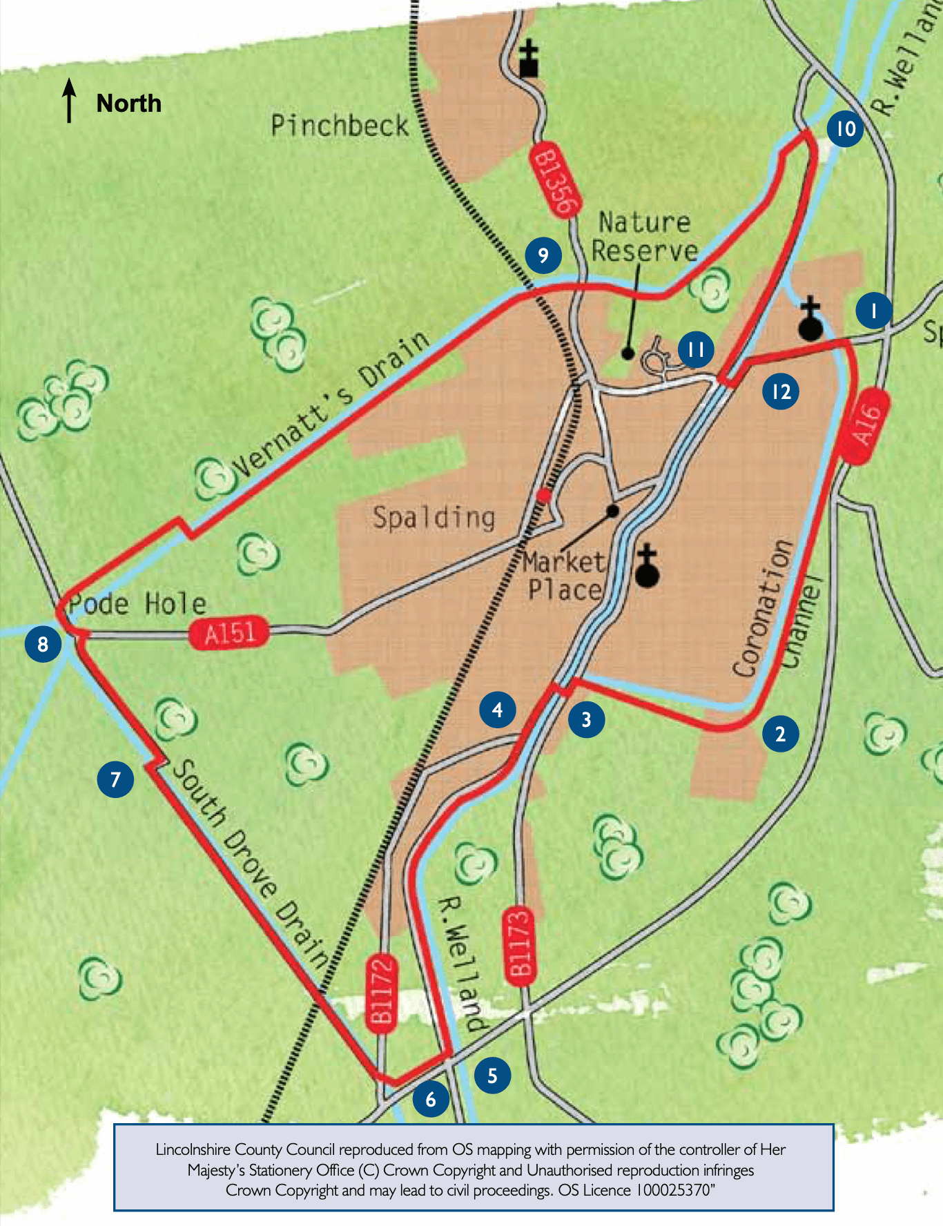
Spalding is the largest market town in the South Holland area. An attractive town,  it is situated on the River Welland with grand Georgian terraces and buildings which reflect the town’s historic importance as a major trading centre and port.

Spalding sits at the heart of The Fens the unique man made landscape reclaimed from the sea. A thousand years ago Spalding and other settlements including Pinchbeck and Whaplode sat on a silt ridge which was surrounded by water during the winter. It was a good place to live, close to a supply of fish and fowl and excellent summer grazing.

To increase the fertile area banks and drains were constructed by the Romans. Reclamation of land continued up to the 13th century. In the 17th century reclamation continued alongside the embankment of rivers including the Welland. Unfortunately the peat soil began to shrink and flood again as it sank below the levels of the rivers and sea. Wind pumps were installed to remove the water from the land and by 1800 more than 700 pumps were in use. However it was not until the arrival of steam power that The Fens were effectively drained. Today electric and diesel pumps are used to maintain the water levels.

The reclaimed land is particularly fertile making it ideal for growing vegetables  and flowers and the area is the centre  of the flower industry with more daffodils grown in South Holland than any where else in the country, with  over 10 000 acres in production.

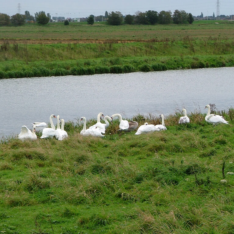
The walk uses many of the local waterways so is an opportunity to see a variety of wildfowl including mallard, tufted duck and swan as well  as great crested grebe, coot, moorhen and water rail.

  • 1Leave the west car park via the pedestrian gate to the water taxi boarding point. Climb the steps up onto the channel bank. Turn left and follow the Coronation Channel to the road. Cross the road and continue to walk along the banks of the Coronation Channel, built in 1953 to protect Spalding from floods.
  • 2Continue along the Channel bank. Look out for Arnold’s Meadow Nature Reserve on the left just before the Channel bends to the right. To enter the reserve turn left at the bridge and follow the track. If you do visit the reserve please stay on the waymarked route and close any gates.
  • 3Where the channel meets the River Welland, and you come to a junction with a road, turn left and follow the roadside path for approximately 160m to a bridge over the river. Cross the road and river. Turn left and walk to a crossroads.
  • 4Continue straight ahead along Cradge Bank. After approximately 100m turn left along River Bank. Follow the public footpath behind the Yacht Club and along the river bank.
  • 5After approximately 1.5 miles (two kilometres), and just before the A16 bridge, turn right down the bank. Cross the road and walk straight ahead along the bottom of the embankment. At the junction with a tarmac path turn right and follow the lane to a road junction.
  • 6Turn left and cross South Drove Drain before turning right along West Road.
  • 7At the traffic lights turn right then left to continue along the opposite drain bank.
  • 8At the T- junction in Pode Hole, turn left to the Fishermans Arms, past Pode Hole Pumping Station. Turn right in front of the pub and follow the bridleway along the drain and then a short section of road. Turn right over the bridge and turn left to continue alongside the drain on the other bank.
  • 9Cross the railway line with care and continue along the drain bank to a junction with a road. Cross this busy road with care and continue to walk along the footpath by the side of the drain. It is well worth taking a detour into Vernatt’s Local Nature Reserve. Continue along the drain bank and walk past the power station.
  • 10At the road turn right and follow the roadside path for approximately one mile (1.5 kilometres) to a roundabout and road bridges over the river.
  • 11Turn left and cross the river. Cross the road and turn left along Holbeach Road.
  • 12After passing Queens Road, and in front of the shops, cross the main road using the central island, and then continue walking in the same direction towards the church and Springfields. Cross the Coronation Channel and at the roundabout turn left to return to Springfields.

The walk uses river bank paths, field paths, roadside paths and quiet roads. You may encounter stiles and livestock.

more information

Starting point

Springfields Outlet Shopping and Festival Gardens

Camelgate (just off the A16)

PE12 6EU

Grid reference: TF 263 240