


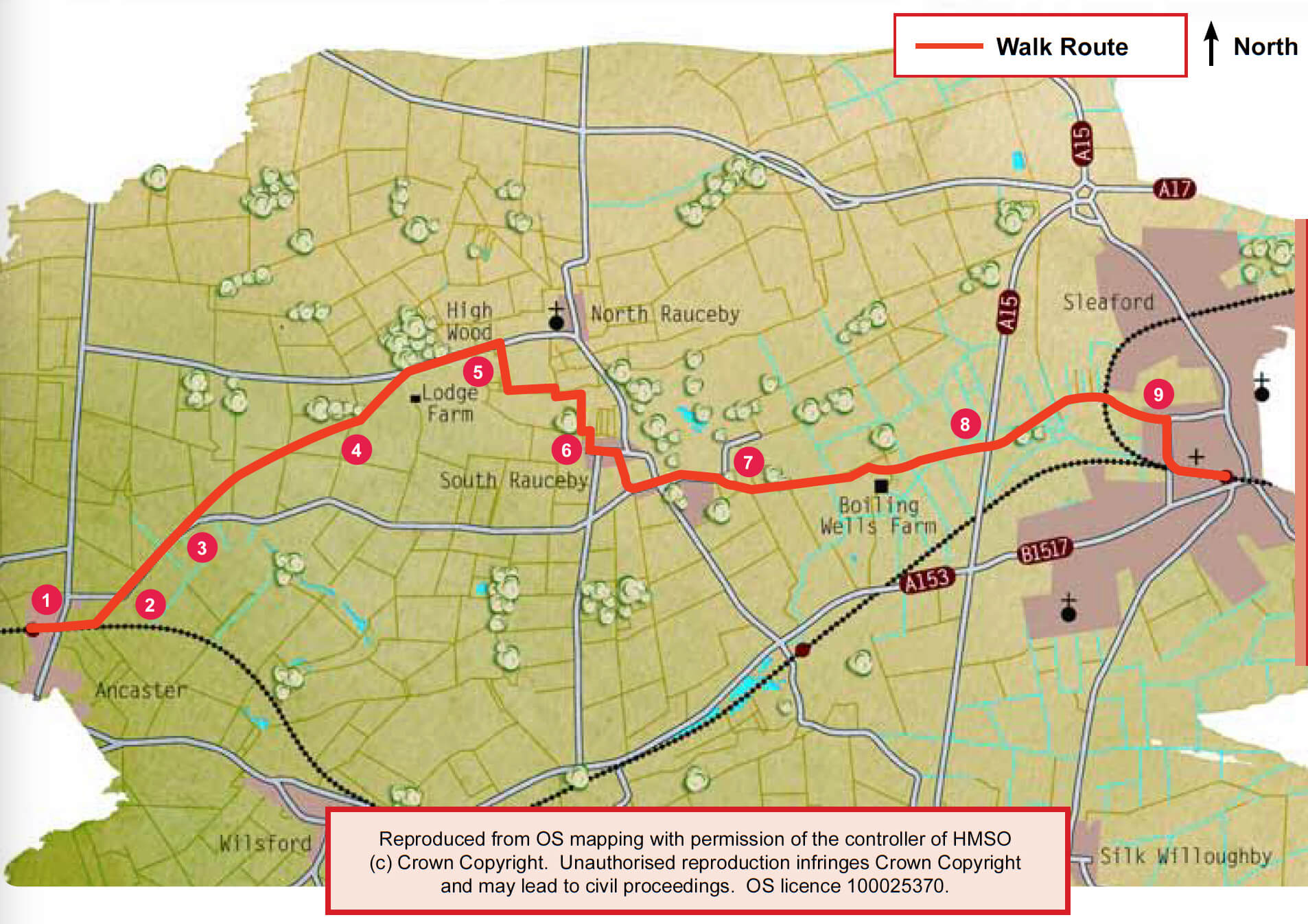
- 1From Ancaster railway station walk down the station approach road. Go past the old warehouses, to the Railway Inn and Ermine Street. Cross the road and walk along the footpath directly opposite, parallel to the railway embankment. As you enter the corner of a field bear left and follow the hedgeline to the field corner and road.
- 2Turn right and follow the road for approximately 0.5 mile (800 metres) to a footpath on the left.
- 3Bear right across the field to the left-hand corner of the copse. Walk through the gap in the hedge and carry on in the same direction, diagonally across the field to a way mark and a gap in the hedge. Turn right and follow the hedgeline. Just before the woodland follow the path through a gap in the hedge to carry on in the same direction, but on the other side of the wood. At the corner of the wood and fields bear diagonally left across the field, heading towards the right-hand corner of the wood on the skyline to meet a farm track.
- 4Turn left along the track and follow it as it heads across the field. Halfway across the field bear left, off the track, and follow the footpath to the hedge. Climb the steps through the hedge, cross the drive to a gap in the stone wall, through a small copse and over another wall. Carry on in the same direction to the corner of the field and road.
- 5Turn right and follow the road for approximately 700 metres before turning right along the footpath and driveway. Walk past the house and turn left after the gate, then follow the hedgeline. Climb the stile and bear right across parkland, to the corner of a stone wall. Turn right and cross a driveway, then follow the fenceline along the edge of the field. Just before the bottom of the field, follow the waymark, and turn left to cross the field, then leave it by the gate below the old mill to join the road.
- 6Turn left and after approximately 120 metres, just before the bus shelter, turn right along a footpath beside a driveway. Walk between a fence and hedge to enter a field. Bear left downhill across the field and then between two houses. Leave the cul-de-sac and turn left. At the T-junction turn right along Rauceby Drive and then almost immediately turn left along Pinfold Lane.
- 7As Pinfold Lane turns right, continue straight on along the track. After approximately 20 metres turn right onto a footpath through a copse. Follow the path through the wooded area and old quarry and past a metal sculpture to emerge in a field at the junction of two footpaths. Follow the left hand path along the field edge. Continue on this path along the edge of two more fields and past the poultry buildings. The path then meets with another path, but continue in the same direction taking the path between a hedge and paddock to a quarry. Through the quarry continue straight on the path that runs across the poultry field to a field edge and to the junction of two paths. Continue in the same direction, on the right hand path, across the middle of the field to the bank of the river Slea. Turn left and follow the path along the river to the A15 road.
- 8Cross this very busy road with care. Carry on walking along the river bank into Sleaford, a distance of approximately one mile (1.6 kilometres).
- 9At the junction with Castle Causeway turn right and follow the roadside path. Walk past the play area and site of Sleaford castle. Just before the rail crossing, turn left and follow the footpath beside the railway line to return to the station or town centre.