Things to look out for
Tick off the landmarks and points of interest you spot along this route as you go.
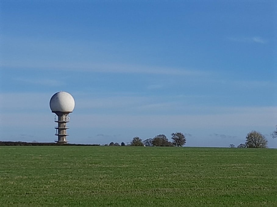
Normanby Top
This is the highest point in the Lincolnshire Wolds at 168m. Nearby is the ‘Golf Ball’, the National Air Traffic Control Radar Installation.


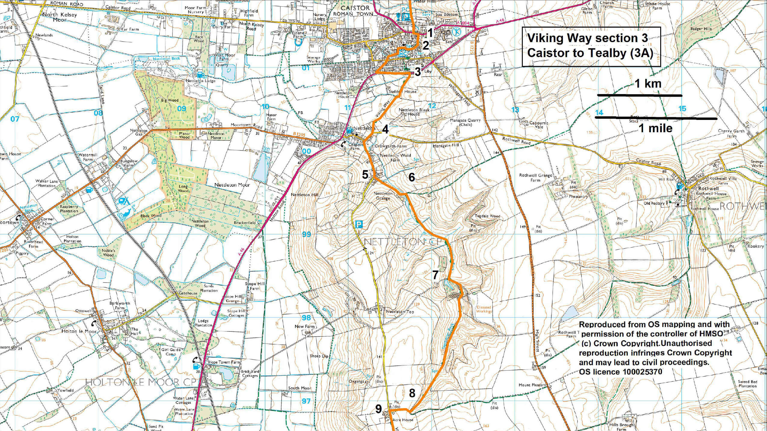
- 1Leave Caistor Market Place via Plough Hill, The Horsemarket and Nettleton Road.
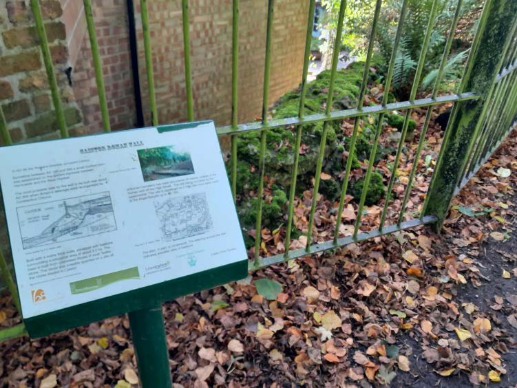
- 2At the Arts and Heritage Centre turn right onto Fountain Street. Walk past the spring and at the junction with Westbrooke Grove turn right. Turn left up the steps and at the top turn left to walk along the path between the churchyard and house. You will walk past a section of the Roman wall. At the road turn left downhill and follow the road to a T-junction. Turn left and almost immediately at another T-junction turn right. At the junction with the A46 turn left and follow the roadside path uphill for approximately 160m.
- 3Cross the busy, fast road with extreme care and follow the footpath down the ramp and to the left along the bottom of the road embankment for approximately 200m to a fence. Follow the path to the right across fields to reach Nettleton village.
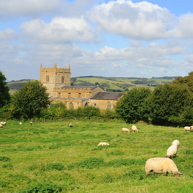
- 4 At the road turn right, then first left (signed Normanby). (To visit the church and pub turn right).
- 5After approx. 450m turn left onto a public bridleway to Nettleton Grange.
- 6After crossing the stream turn right onto the public footpath to walk along Nettleton Valley. Follow the path for approx. 0.75 miles (1.2 kilometres) to a track and woodland.
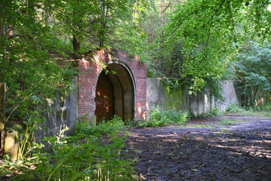
- 7Turn left and then right through the woodland and past the old mine workings. Keep on the footpath as it leaves the woodland and follows the valley floor before climbing up to the head of the valley.
- 8At a junction with a bridleway turn right to a road.
- 9Turn left and follow the road ahead for approx. one mile (1.6 kilometres)
- 9Turn left and follow the road ahead for approx. one mile (1.6 kilometres)
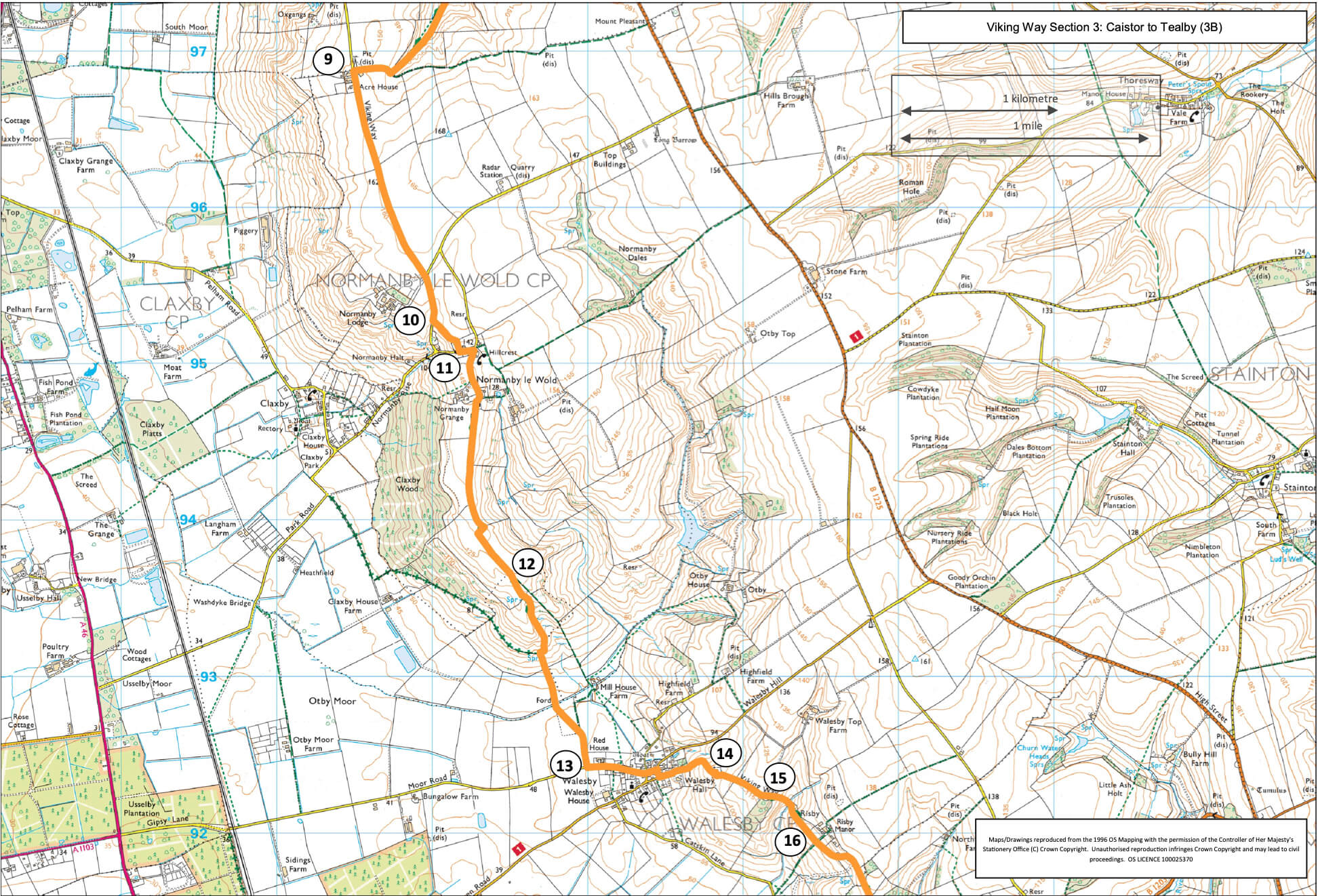
- 10Turn left on to a public footpath across fields to Normanby le Wold.
- 11At the road turn left, and at the junction turn right to the church. Follow the bridleway past the church and out onto the hilltop plateau. Follow the bridleway, straight ahead beside the hedge, for approx. 0.75 miles (1.2 kilometres) to where the bridleway divides into two.
- 12Bear right down the hill to a track and then continue ahead to a road and the edge of Walesby village.
- 13Turn left into the village. At the T-junction turn right and then left on to a footpath to the Ramblers church.
- 14Go into the churchyard and walk around the church. At the church door turn right to a gate. Bear left across the field to a gate in the corner. Walk straight across the next field to a track.
- 15Cross the track, go through a gate and bear left through a copse and then downhill along a fence line to the valley bottom. Cross the bridge and walk straight ahead uphill. Walk in front of the house and garden to a lane and junction with a bridleway. (To visit Market Rasen see separate walk – Viking Way – Market Rasen).
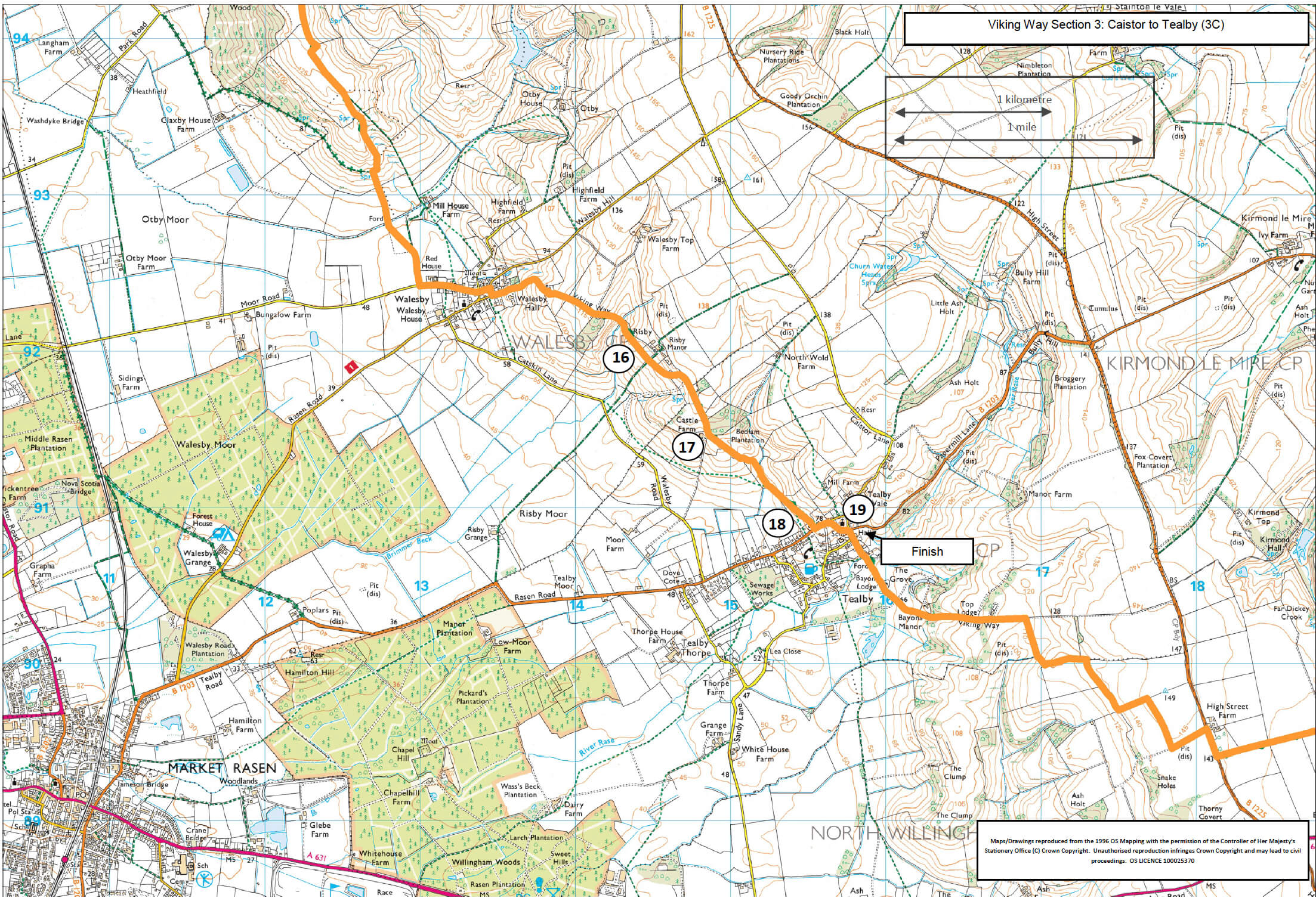
- 16Cross the lane and continue ahead alongside the fence line. At the track bear left through a gate and then up a slope to a gate in the field corner. Follow the path along the edge of the wood.
- 17At the field continue straight ahead along the top of the slope (beside an old fence line) before dropping down a slope to a fingerpost in the hedge line. Continue downhill following the path beside the hedge, over a bridge to a second bridge and junction of paths. Turn left over the bridge and then right along the boardwalk to a gate. Bear left to follow the path across the field and then past the side of a cottage and to a road.
- 18Cross the road with care, turn left and follow the pavement past the church to a crossroads.
- 19Turn right onto Beck Hill past the Village Hall and shop.