


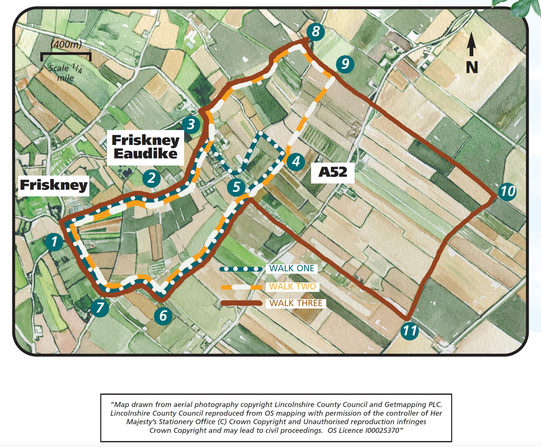
- 1Turn left out of the Village Hall car park and follow the public footpath sign behind the beacon, along the edge of the field towards the church. You will be walking behind the village shop. At the road turn right and then left under the arch to enter the church grounds. At the front door turn right, through the gate and cross the road to a public footpath. On the left is the site of the old general stores and post office and the primary school is on the right. Follow the tarmac path to a junction with a road.
- 2Continue straight ahead along Chapel Lane. Follow the road until it bends right and the chapel is in front of you. Turn left along a footpath before Chapel House, going behind the house and chapel to a road.
- 3Turn left along the road. At the crossroads turn right onto Low Road. Follow the road for approximately 0.75 miles (one kilometre).
- 8Turn right into Mill Lane and follow it for approximately 750m to the A52 road.
- 9Cross this busy road with care and walk straight ahead to a finger-post. Continue straight on keeping the farm buildings on your right, and follow the track ahead for approximately 0.75 miles (1.25 kilometres). This is a permissive path so please observe the Countryside Code.
- 10Turn right to follow the public footpath beside a ditch. When the ditch bends to the right continue straight ahead towards the trees. With the trees on your right you are walking along the first sea bank, and to the left is the old RAF Observation Tower. Continue to a road.
- 11Turn right onto Sea Lane and follow it to the Barley Mow pub. Cross the main road again with care and walk down Eaudyke, opposite, for approximately 500m before turning left onto the public footpath at point 5 on the map.
- 5Follow the path over the culvert and across the middle of the field. Walk past two houses and then along a tarmac drive towards a bungalow. As the drive bends to the right, in front of the bungalow, walk straight ahead along the footpath to a road.
- 6Turn right along Lentons Lane to a T-Junction. At the junction turn left into Field Lane. Follow the road round the ‘s’ bends.
- 7At the junction turn right into Church Road to return to the Village Hall.