


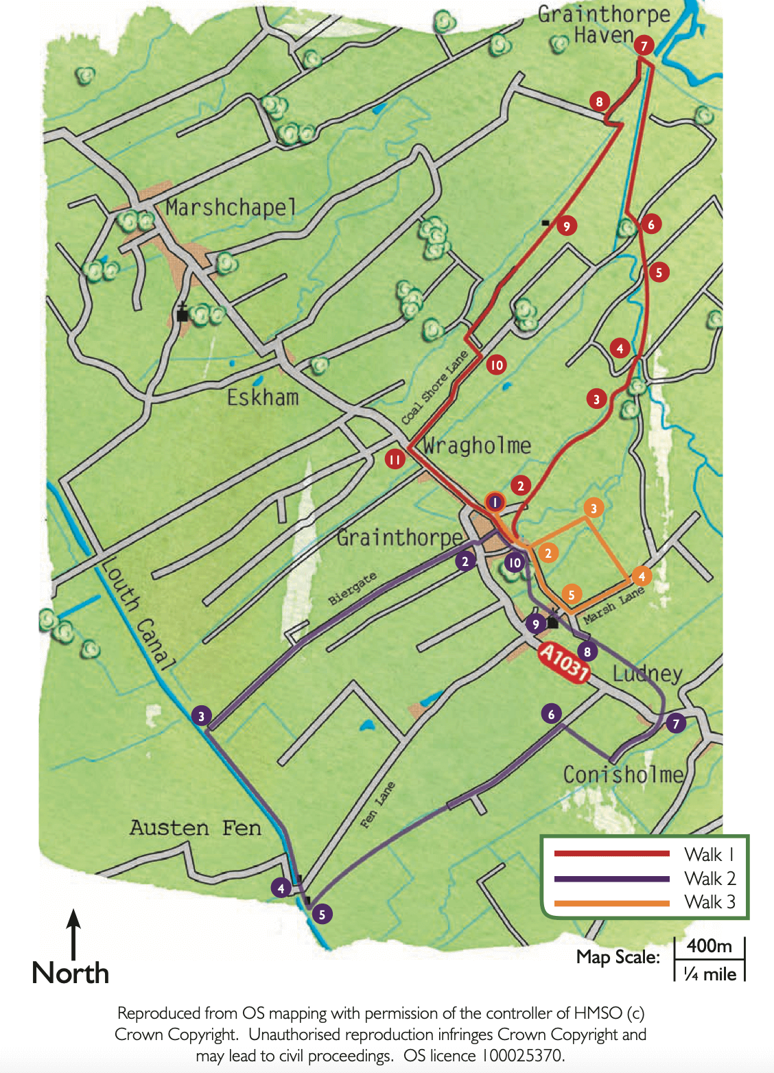
- 1With your back to the Methodist chapel turn left. After approximately 100m turn left onto a footpath and walk through a yard and across a garden and through a gap in a hedge. Turn left, cross a bridge and bear right across the field toward the corner of the hedge by the house.
- 2Continue straight ahead and follow the footpath across the field to a footbridge that will come into view. Cross the bridge and bear slightly left across the next field to a drain. Turn right and walk beside the drain.
- 3After approximately 0.25 miles (400m), turn left over the drain then right into a copse. Continue alongside the drain, but on the opposite side.
- 4At the track turn right over the drain and then left to follow the footpath alongside the drain. After approximately 0.25 miles (400m), as drain bends left, keep straight on across the field to meet the drain again. Continue beside the drain.
- 5At the track turn right and after approximately 150m turn left over the foot bridge beside some trees. Walk across the field, heading to the corner of the wood ahead.
- 6t the wood, bear left across the next field to a drain, the Seven Towns North Eau. Turn right and walk alongside the drain.
- 7At the sea bank and pumping station turn left to reach Grainthorpe Haven. Turn left again along the track beside the pumping station, heading back inland.
- 8At the drain and signpost, cross the bridge and turn left and follow the footpath beside the drain for approximately 100m before turning right along the signposted track. After approximately one kilometre and where the ditch bends right, continue straight ahead towards the house.
- 9Walk between the house and barn and follow the driveway for approximately 500m to where it bends sharp left. Follow the footpath sign into the field ahead but then turn immediately left to walk along the edge of the field but parallel to the track. At the field corner leave the field to join the road. Permission to walk this field edge has been kindly provided by Mossop Farms Ltd.
- 10Turn right and follow the lane to a T-junction.
- 11Turn left and use the roadside path. At the War Memorial carry straight on along the High Street, and walk through the village to the chapel and starting point.