


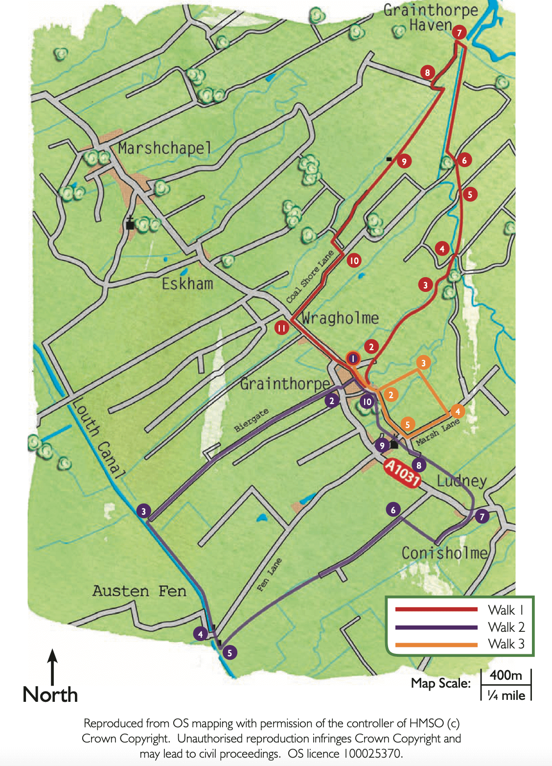
- 1Walk along Chapel Lane opposite the chapel.
- 2At the T-junction turn right and after approximately 50m turn left onto Biergate. Follow the lane for 1.5 miles (2.5 kilometres) to its junction with Louth Navigation canal.
- 3Turn left and walk along the canal bank.
- 4Walk past the old warehouse, cross the road and continue straight ahead on the public footpath.
- 5Approximately 100m after crossing the road turn left onto a public footpath and walk between the house and the barn. Follow the path straight on beside the drain.
- 6After approximately 1.5 miles (2.5 kilometres) turn right onto a grass track between two hedges. Follow this to a lane. Turn left and follow the lane to a T-junction.
- 7Cross the road with care and continue straight ahead on the public footpath. Walk straight across two paddocks and cross a bridge. Bear slightly left across the next field to a signpost and bridge in the hedgeline. Walk straight ahead along the edge of the field. Cross the next narrow field and then straight on beside a hedge and then follow the drain to join a grass track between a fence and drain.
- 8Where the track forks, bear left. Cross the bridge and bear left to the far corner of the paddock. Enter the churchyard, turn right and follow the path in front of the church to the gate and road.
- 9Leave the churchyard, cross the road and carry straight on along the public footpath. Walk straight on along the field edge. Leave the field and turn right along the drive. At the gateway turn left to continue along the public footpath. Continue straight ahead, over a bridge, and enter a field. Walk straight across the field and then beside the hedge to a bridge. Cross the bridge and walk straight on into another field. Bear right across the field to a bridge in the middle of the fence line. Cross the bridge and follow the field edge to join a driveway in front of some houses.
- 10At the road turn left to return to the starting point.