Walking

Saltfleet Walk One

A short walk from Saltfleet through the grazing marshes landscape with the opportunity to visit the isolated St Botolph's church.

Starting point
Project Information Hub at the Saltfleet New Inn
Main Road
Saltfleet
LN11 7RZ
Grid reference: TF 454 938

  • Linked to Public TransportLinked to Public Transport
  • RefreshmentsRefreshments
  • Dog FriendlyDog Friendly

Lying between the coast and the Wolds, Lincolnshire’s coastal grazing marshes are a nationally threatened habitat supporting a rich variety of wildlife with a distinctive landscape and rich cultural history. Big skies and long views dotted by churches give the grazing marshes a unique character,  this special landscape is full of untold stories and hidden clues that tell of how this landscape has been shaped through history.

Saltfleet is believed to have been one of the biggest ports outside London during the 12th to 15th centuries, providing important trade links to Europe. Lincoln Longwool fleeces, revered for their long yarn, and salt were shipped to Europe whilst tobacco, spices, gin and building materials would be brought back on the returning ships. The import of building materials during this period explains why many local buildings are constructed from European stones. The port contributed to the wealth of local market towns such as Louth, Alford and Burgh le Marsh, but was also responsible for a rise in smuggling and a wealth of folklore that now surrounds these communities.

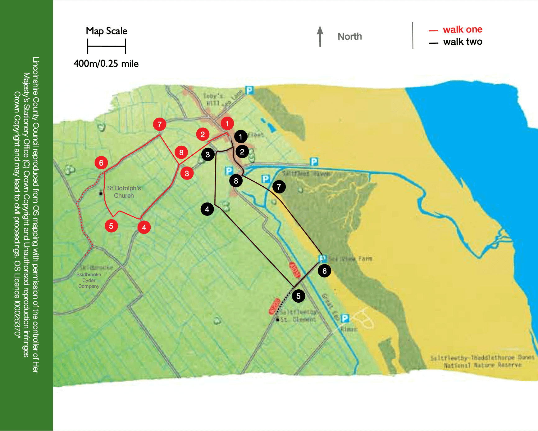
Skidbrooke was once the main village in the area, located around the now disused church of St Botolph’s. Reclamation of land through salt making and an increasing popularity of the Lincoln Longwool’s fleece during the 13th century meant villagers moved closer to the newly reclaimed coast.  St. Botolph was the patron saint of wayfarers and is said to have rid the marshes of their ‘devils’—in fact, he probably had the marshes drained and eliminated the ‘marsh gas’ with its night glow.

  • 1With your back to the New Inn turn right along Main Road. At the crossroads turn left down Pump Lane, at the side of the Crown Inn.
  • 2At the end of the houses turn right onto a public footpath and over the bridge. Walk straight across the playing field to another bridge. Cross the bridge and continue straight ahead along the field edge to a road.
  • 3Turn right and walk along the road into Skidbrooke.
  • 4After approximately 0.5 miles (750m), where the road bends to the left, leave the road to join the public footpath ahead. Walk diagonally right across the field to where a field edge ditch bends at right angles. Follow the path beside the ditch to the field corner where there is a junction of paths.
  • 5Turn right and follow the path along field edges and beside a ditch towards the church.
  • 6At the road you have a number of options: To continue the walk turn right and follow the road for approximately 0.5 miles (750m). Go to directions at 7. To visit St Botolph’s church turn left and follow the road and then signs to the church. To visit Skidbrooke Cyder Company turn left, walk past the entrance to St Botolph’s church to a T-junction. Turn left and then right along Saddleback Road.
  • 7Turn right onto a track beside a drain and follow it to a road.
  • 8At the road turn left, cross the drain, turn left and then right to follow the public footpath along the field edge and then across the playing field to a road. Turn left and follow the road to return to the starting point.

The walk uses quiet roads and field paths. You are likely to encounter stiles and livestock.

more information

Starting point

Project Information Hub at the Saltfleet New Inn

Main Road

Saltfleet

LN11 7RZ

Grid reference: TF 454 938