


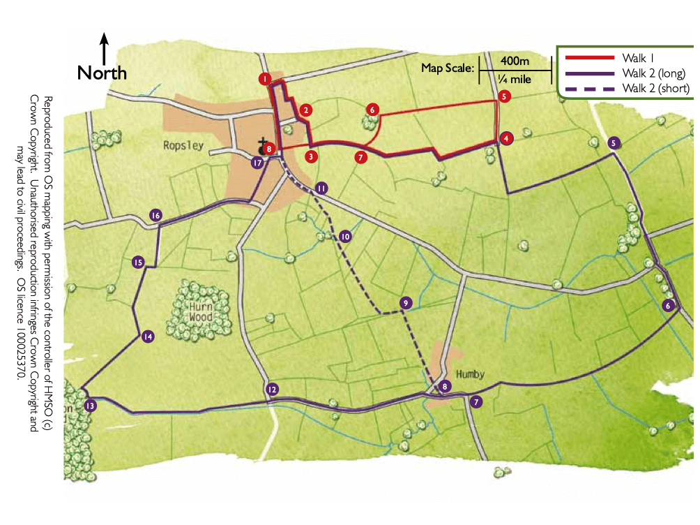
- 1Take the public footpath opposite the village hall and next to a bungalow. Follow the track straight ahead to the fence. Turn left uphill for approximately 50m before turning right to a road.
- 2Turn left and at the top of the road take the public footpath in the right-hand corner. At the field turn right and walk along the field edge to a junction with another footpath.
- 3Turn left and after approximately 300m, at a junction of paths, bear right and follow the track alongside the hedge. Continue along the track as it bends left. Follow the track as it turns right and then left to an area of trees and farm buildings.
- 4Turn right and at the next field corner turn left to continue to follow the track and path for approximately 1 km (0.6 mile).
- 5At the junction with a restricted byway turn right and follow the track to a road. Follow the road straight ahead and at the junction bear left, signed Hanby.
- 6After approximately 400m turn right onto a public footpath. Cross the bridge over the East Glen River and continue straight on along the field edge. After approximately 1.1 km (0.7 mile) cross the stile/gate, bear left and walk between hedges to a road.
- 7Continue straight ahead along the road into Little Humby village.
- 8At The Green continue straight ahead along the road, cross the ford to join New England Road. Follow the road for approximately 900m (0.6 mile) to where it bends sharp right.
- 12Turn left onto the track and then almost immediately right onto a footpath and follow the field edge towards the woodland, Kirton Wood.
- 13Follow the path into the woodland and then almost immediately turn right over a bridge. Turn right and follow the field edge, with the drain and hedge on your right for approximately 500m.
- 14At a junction with another path continue ahead and over a bridge and bear right to continue along the field edge.
- 15At the field corner turn right, walk around the pond and trees, and over a bridge. Continue ahead along field edge to a road.
- 16Turn right, walk past two public footpaths on your left before turning left onto a public footpath approximately 60m before a T-junction. Follow the path towards the church to a road.
- 17At the road turn right and at the T-junction turn left and at the end of the village turn right onto Braceby Road and the Village Hall.