Things to look out for
Tick off the landmarks and points of interest you spot along this route as you go.


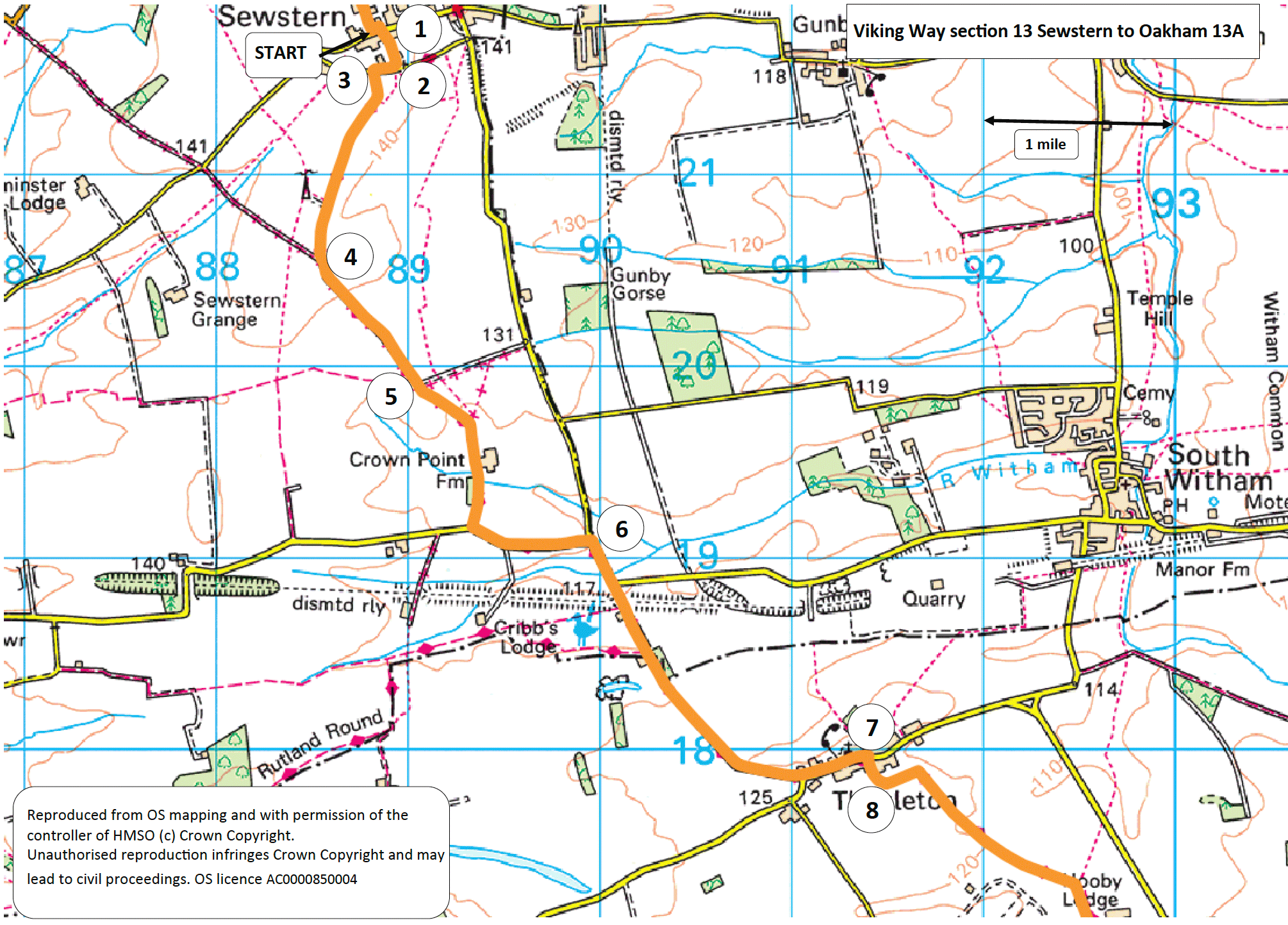
- 1Turn right into Church Lane and follow it to the junction with Back Lane.
- 2Turn right onto Back Lane and follow it for approximately 130 metres.
- 3Turn left onto a public footpath along a track and follow it for approximately 0.6 miles (one kilometre) to a junction with another track.
- 4Bear left to continue along the track. Where the stone track bears left leave it to continue ahead along a grass track and then tarmac lane to a road.
- 5Turn left and walk along the road with care.
- 6At the T-junction turn right (signed Thistleton) and follow the road for approx. one mile (1.6 kilometres) into Thistleton village.
- 7In the middle of the village turn right onto a public footpath signed Viking Way. Continue ahead through a gate to a field edge.
- 8Turn left and follow the path along the filed edge for approximately 150 metres before turning right to walk across the field. Continue in the same direction across the next two fields to a hedge end. Bear right, keeping the hedge on your left, to walk along the field edges to a road.
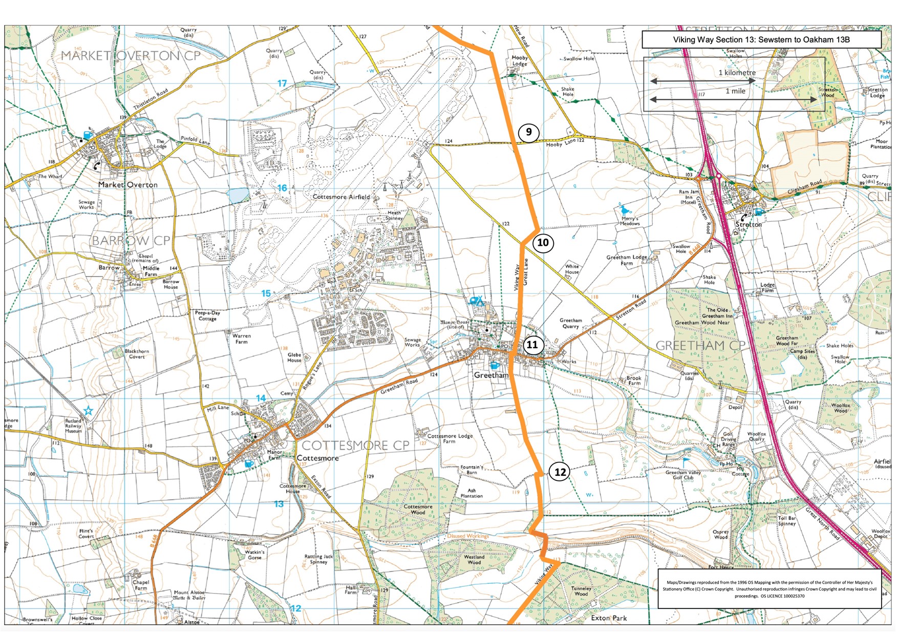
- 9Cross the road and continue along the field edge footpath and then between crops to a track. Turn right to reach a road.
- 10Cross the road and continue straight ahead along the tarmac lane. Follow it into Greetham village and to a T-junction with the main village road.
- 11Turn right and almost immediately turn left, taking care crossing the road, to a public footpath up a flight of steps. Follow the path between fences/hedges to a track. Continue ahead in the same direction along the track. Walk past the farm and onto a gate/bridge/stile. Cross the bridge.
- 12Turn right and then after approximately 50 metres turn left to follow footpath along a track. Follow the track approx. 1.5 miles (2.5 kilometres) to farm buildings on the edge of Exton village.
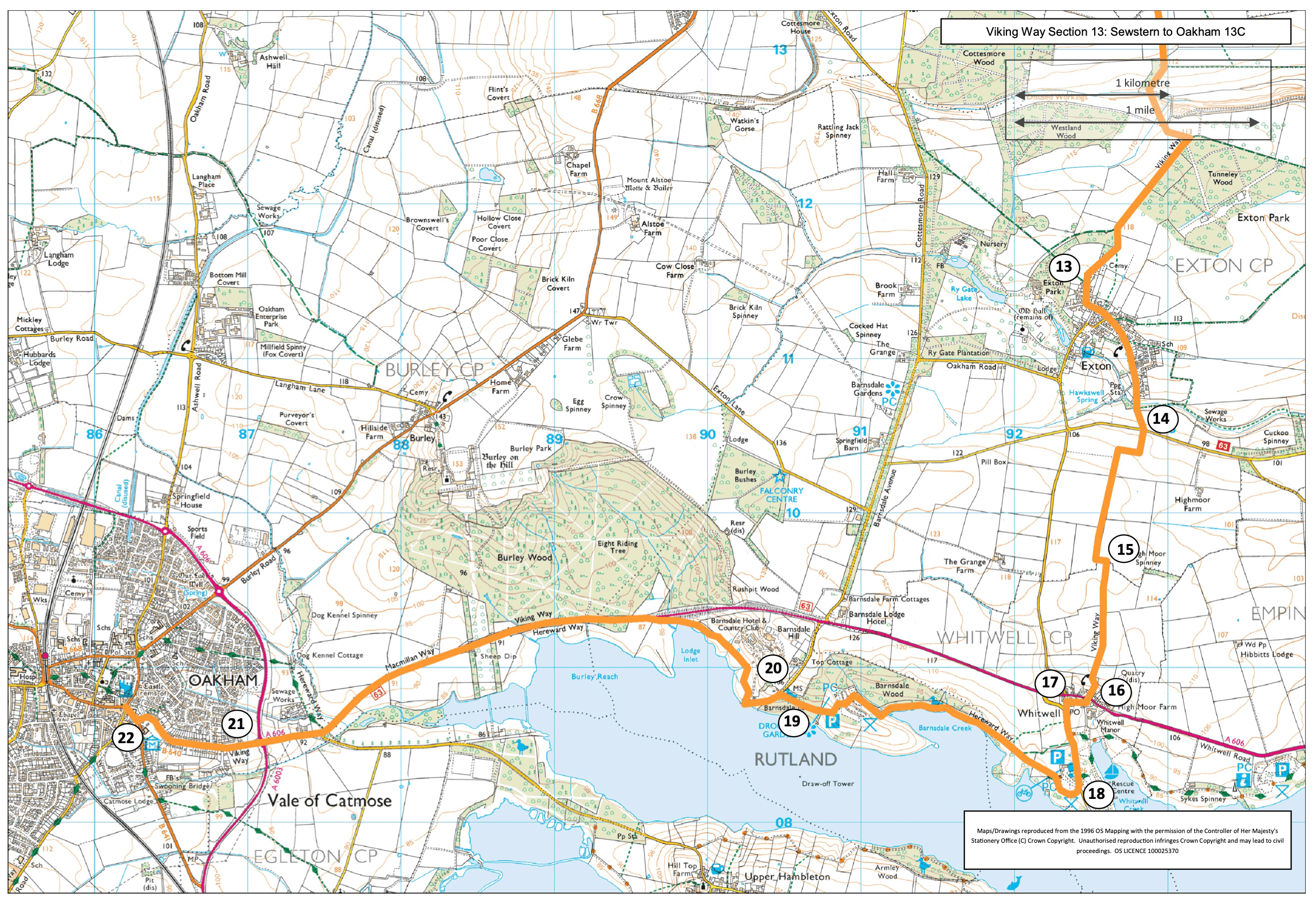
- 13Bear left through gate and then follow the village road to the right and then left, past the Town Pump and straight on along Top Street. Continue straight on as it becomes Stamford Road and then Empingham Road.
- 14At a T-junction on the edge of Exton cross the road and continue straight ahead on to the footpath and along the field edge. At the third corner leave the field by going straight ahead through a gap in the hedge and over a bridge. Continue straight on along the field edge and at the corner continue ahead over a bridge and along the edge of the next field. Just before the field corner turn left on the footpath and into an area of woodland. Bear left to walk along the wood edge.
- 15After approx. 50m turn right through the woodland. Leave the woodland through a gate and continue straight ahead along the field edge. Cross a track and continue straight on. Just before the field corner bear right over a stile and then keep left along the field edge to the corner and continue straight on into the next field. Turn left into the next field and then right and follow the hedgeline downhill through the pub garden to the road.
- 16Cross the busy road with care, turn right and then left and follow the path and then road past the church. Turn left after the church.
- 17At the T junction turn left and follow the pavement into the Rutland Water complex.
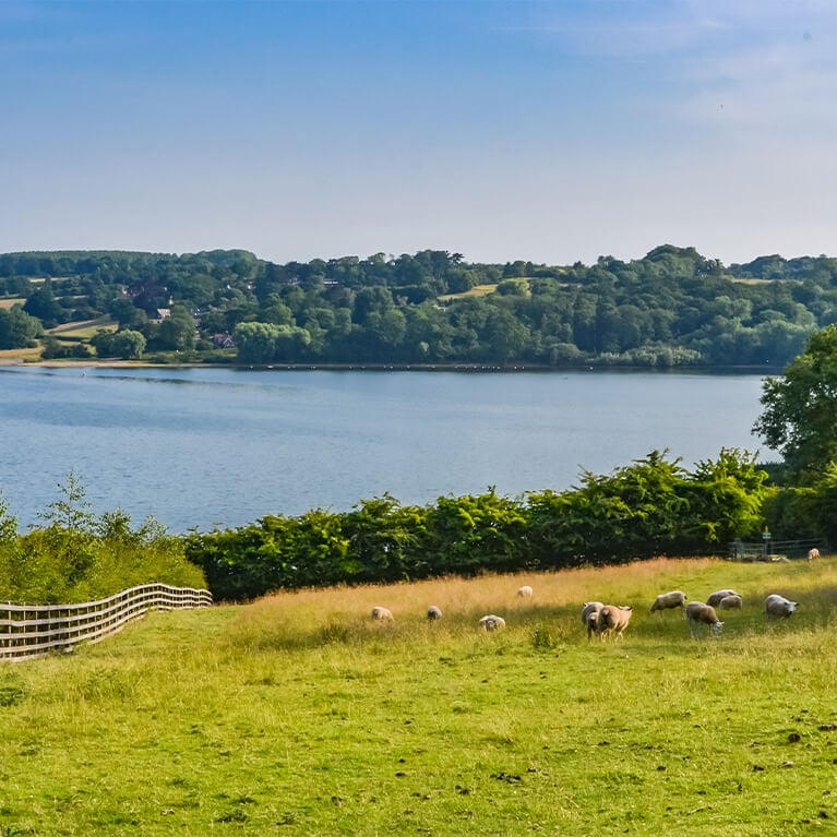
- 18Turn right into the car park entrance and continue ahead towards the café and toilets. Pick up the signs for the cycleway to Barnsdale and Oakham and follow the track around the edge of Rutland Water. Follow the track for approximately one mile to Barnsdale's car park.
- 19 Walk through the car park and then along the road to leave the car park. Continue straight ahead along the road.
- 20At the mini roundabout turn left (signed Egleton) and at the end of the road bear right to continue along the track around Rutland Water. Continue as the track becomes a tarmac pavement beside the road. Follow it for approximately 1.75 miles (three kilometres) to a roundabout.
- 21Cross the road with care and continue straight on to Oakham.
- 22At the roundabout turn right to Oakham Library where the route ends and if the Library is open you can sign the finishers book.