Walk
Loop
5.6miles
(9.01km)
2 hours
45 mins

Walking

Viking Way Shorts Skillington Walk

Skillington

Skillington is a small village sitting in the lovely undulating countryside of South Kesteven.  On this circular walk you will explore the local countryside and pass an old RAF site now used by a gliding club, an ancient drove way and a short section of the Viking Way.

Starting point
The Square
Skillington
Grantham
NG33 5HB

Grid reference: SK 898 257

Many of the buildings in Skillington village are constructed of the locally quarried mellow stone and the village is a conservation area.

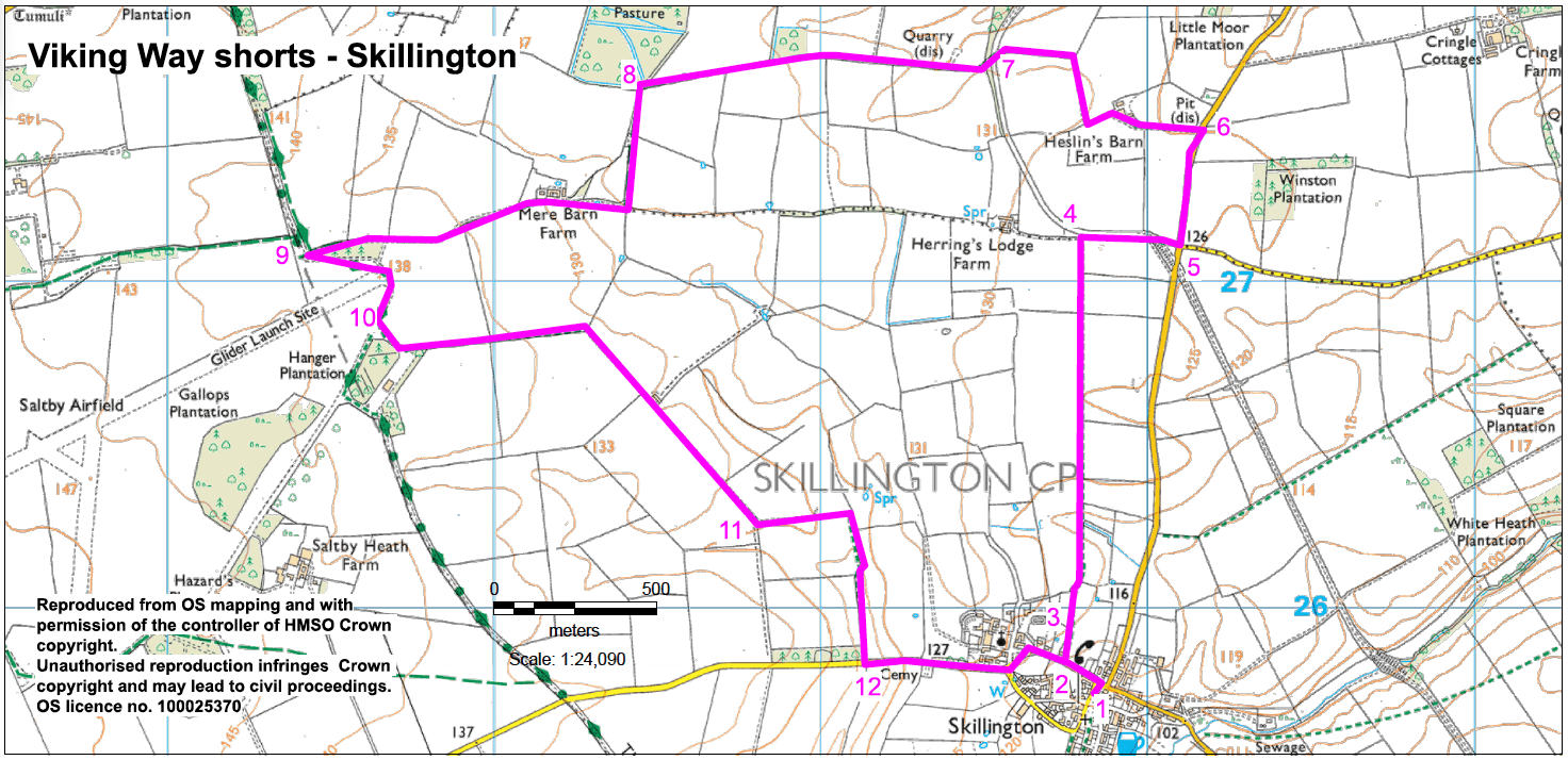
The Drift forms part of the Lincolnshire-Leicestershire border and is an ancient drove way and now forms part of the Viking Way. Between the A607 and Saltby airfield the Drift is part of a Site of Special Scientific Interest (SSSI).  It is designated because it is a good example of Lincolnshire limestone grassland. Lowland calcareous grassland like this is rare throughout Europe. In summer it is covered with a variety of colourful wildflowers.

The airfield at Saltby, is now used by Buckminster gliding club.  It was originally built and opened as a grass airfield in 1941. In 1944 it was transformed into a standard-pattern 3-runway airfield. Towards the end of the war it became a USAAF base. It was also a Troop Carrier airfield.

Look out for the Dovecote as you return to the village.  It can be seen near the church and was probably originally associated with the nearby moated manor house. It was built to house 450 birds

The stump on the village green by the church is the moot cross, believed to have originally stood on the main green in the middle of the village. 

  • 1Walk downhill to a T-junction. Turn left along Church Street for approx. 120m.
  • 2Turn right onto a public footpath and walk straight ahead across the field to a gate in the far hedge.
  • 3Bear slightly left and follow the path along the field edge. Continue straight ahead along field edges to a tarmac track.
  • 4Turn right along the track. Where the track bends to the right bear left across the old railway line to hedge and field. Turn right and follow the field edge to a road.
  • 5Turn left along the road for approx. 350m then turn left on to a bridleway at Heslins Barn Farm.
  • 6Approx 75m past the farm turn right to continue along the bridleway following field edge. At the field corner turn left and follow the field edge (with hedge on your left) to a concrete roadway.
  • 7Cross the roadway by bearing left to a track opposite and continue to follow the bridleway.
  • 8After approx. 0.6 mile (1km) turn left to continue along the bridleway and stone track. Walk in front of a farmhouse and walk straight on along a grass track. Follow the track through the hedge and continue in the same direction walking between a wood and hedge to a junction with a track (The Drift and Viking Way).
  • 9Turn left to walk along the Viking Way as it crosses the end of the gliding club runway (take extra care and follow warning signs).
  • 10At the hangar turn left onto a footpath (and off the Viking Way). At the end of the building bear slightly left to follow footpath along the field edge. Keep on the path and track as it passes farm buildings on the left.
  • 11Approx 450m past the farm buildings and where the track bends to the right turn left to keep on the footpath. After a further 250m, at a hedge, turn right and continue on the footpath as it doglegs right and left along field edges to a road.
  • 12Turn left and follow it into and through Skillington village to the starting point.

The walk uses a mixture of field paths, tracks and roads. There are stiles and you may encounter livestock.

more information

Starting point

The Square             

Skillington

Grantham

NG33 5HB

more about the trail

Viking Way

The Viking Way is a long distance - 147 mile way-marked trail spanning from the River Humber through Lincoln to Oakham in Rutland. The route is signposted with an icon of a Viking helmet on a yellow disk.