(2.74 km)
Walking
Water Railway Southrey To Stixwould Walk
Southrey,Stixwould
The Water Railway is a multi-user route linking Boston and Lincoln, much of it following an old railway line. As it is close to the river there is plenty of wildlife to look out for, as well as sculptures reflecting the local landscape and heritage.
Starting point
Ferry Road
Southrey
LN3 5TA
 Parking
- Linked to Public Transport
 Cycle friendly
 Bridleway
- Refreshments
- Dog Friendly


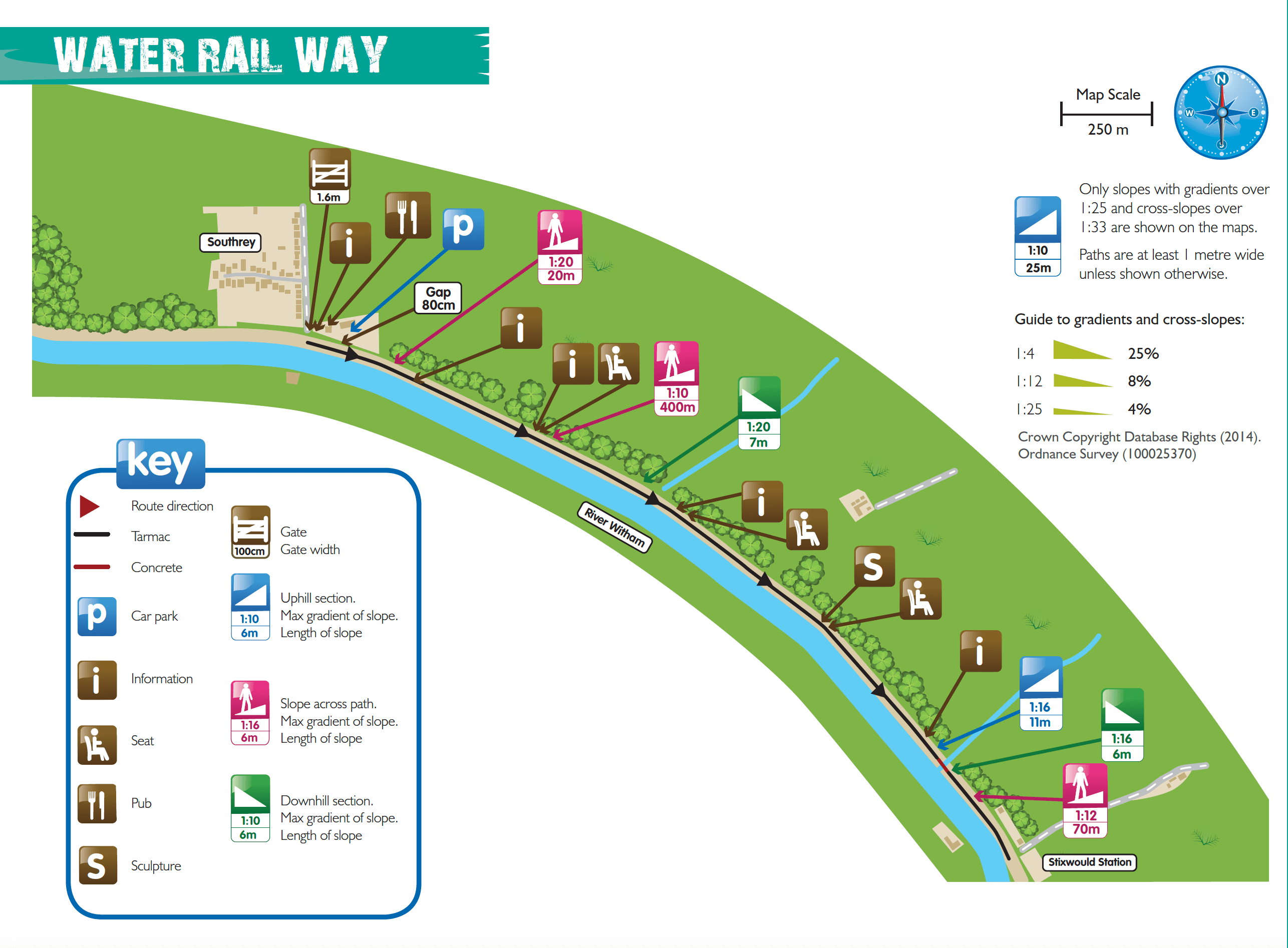
The Water Railway is located along Ferry Road, Southrey. There is a car park at the end of Ferry Road which consists of uneven compacted stone with some loose stones.
The path surface consists of mainly tarmac with one short stretch of concrete.
Steepest uphill section: 1:16 (6%) for a distance of 11m
Steepest downhill section: 1:16 (6%) for a distance of 11m
Narrowest point: The path is over two metres wide but the gates to access the route are 1.6m wide
Greatest cross slope: 1:10 (10%) for a distance of 400m
more Countryside for All routes
Chapel Six Marshes Walk
Deeping Lakes Walk
Frampton Marsh Walk Three
Freiston Shore Walk One
Hartsholme Country Park Walk
Horncastle Spa Trail Walk
Louth Hubbard’s Hills Walk
Mareham Pastures Walk
Skegness Gibraltar Point National Nature Reserve Walk
Skegness Waterways Walk
Westgate Jenny’s Woods & Sir Joseph Banks Country Park Walk
Whisby Nature Park Coot Lake Walk
Whisby Nature Park Grebe Lake Walk
Whisby Nature Park Thorpe Lake Walk
Woodhall Spa Airfield Walk
more about the trail
Viking Way
The Viking Way is a long distance - 147 mile way-marked trail spanning from the River Humber through Lincoln to Oakham in Rutland. The route is signposted with an icon of a Viking helmet on a yellow disk.