 Parking
 Linked to Public Transport
 Refreshments
 Dog Friendly
Things to look out for
Tick off the landmarks and points of interest you spot along this route as you go.


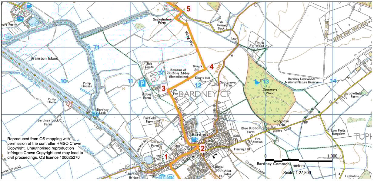
- 1At the road turn right and walk to the centre of the village.
- 2Turn left onto Wragby Road and then left again onto Abbey Road.
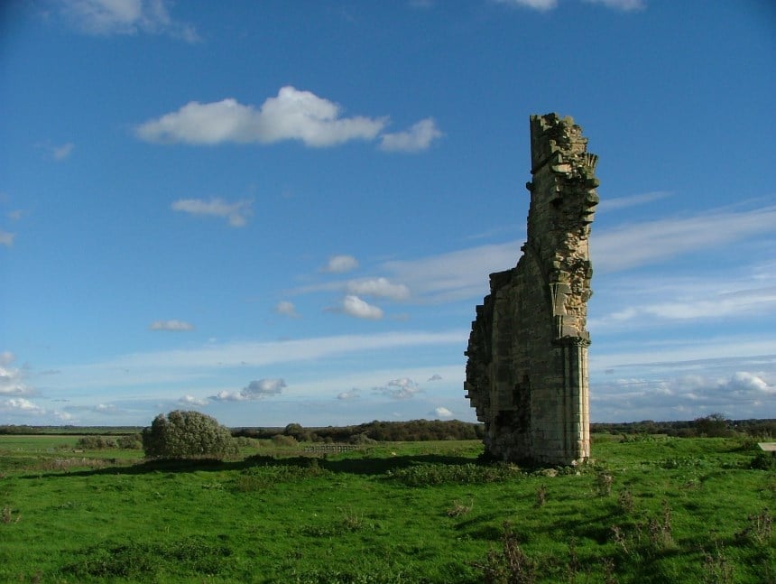
- 3At the end of the road turn right onto a bridleway next to the old water tower. (To visit Bardney Abbey site continue straight ahead).
- 4At the mound, known as King's Hill, turn left onto a footpath. Follow the path across a field and then along field edges to a farm. Turn right, walk through the farmyard, to a road.
- 5Turn left, and walk along the road with care for approx. 0.5 miles, to the first junction.
- 6Turn right, signed Stainfield. Take the second public footpath on the left, just after the houses, and cross the field to return to the road. Turn left and almost immediately right onto another path. Walk diagonally across the fields towards the church.
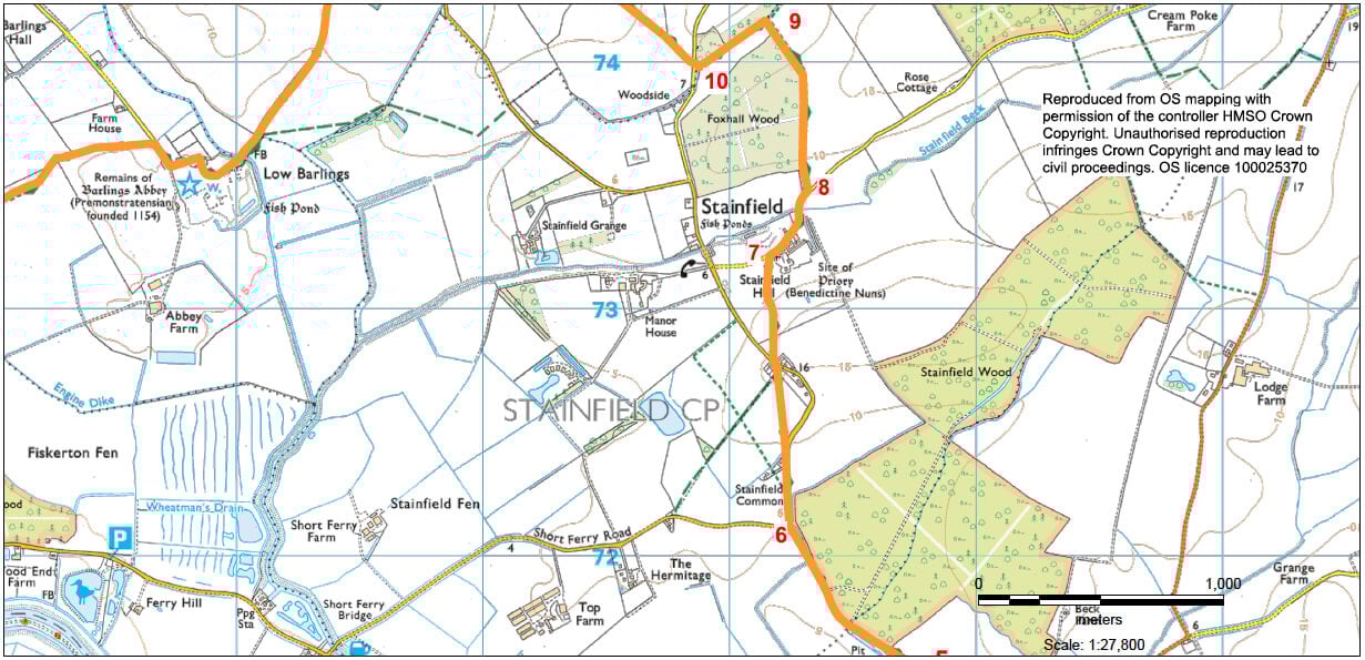
- 7At the road, by the church, turn right and follow the road over the cattle grid for approx. 300m.
- 8Turn left onto a footpath.
- 9At the end of the wood and at a junction of paths turn left. After approx. 300m turn right to a road.
- 10 Cross the road and follow the bridleway along the field edge and where the hedge goes off to the right continue straight ahead across the fields to a road.
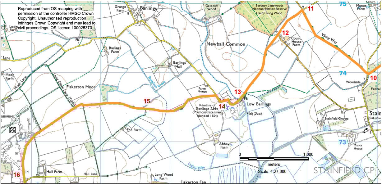
- 11 Turn left and follow the road.
- 12As the road bends to the left turn right onto a bridleway and walk across the field to a gate and dyke. Follow the bridleway alongside the dyke to a bridge.
- 13 Cross the bridge and bear right to a gate between the house and stables. Follow the bridleway through the gate and then bear left along the driveway to a road.
- 14Turn right and after 100m turn left onto a footpath and follow it along field edges to a bridge. Cross the bridge and walk straight ahead across the field to the corner.
- 15Follow this bridleway ahead for approx. 1.5 miles to reach a road.
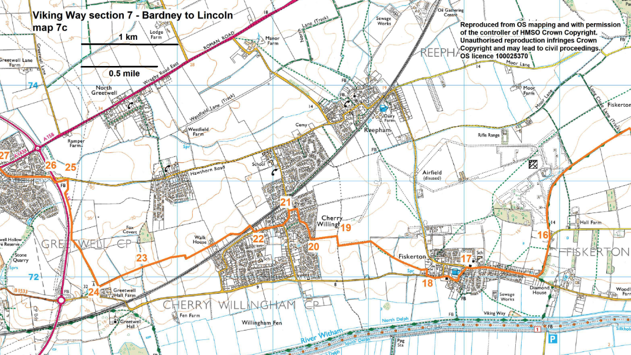
- 16Turn right. At the T-junction with the main village road turn right and walk into Fiskerton village. Walk past the village hall to the village green.
- 17Bear left along High Street past the Carpenters pub and follow the road to the right past the church (St Clements).
- 18 Take the third turning on the right, Plough Lane. As the road bends to the right turn left on to a public footpath, signed Cherry Willingham. Enter the field and bear slightly right across the field to some steps and bridge. Cross the bridge and bear diagonally left up the slope to the left of the field corner. Go through the hedge and walk straight ahead along the field edge, with the hedge on your right, to the corner. Turn right, through the hedge, and then left and follow the path beside the ditch. Follow the field edge to the right for 100 metres.
- 19Turn left to follow the footpath along the field edge towards the bungalows (Cherry Willingham village). Continue between the bungalows to a road.
- 20 Turn right and follow the pavement. Turn right onto Dale Avenue and at the T-junction turn left, past the shops.
- 21At the next T-junction turn left. Continue along High Street.
- 22Turn right onto Green Lane. At the end of the lane continue straight on along the bridleway (track) and continue as it bends right, then left before dropping downhill to a stream.
- 23Cross the stream and continue ahead along the field edge. At the corner cross the bridge and continue straight on along field edge to a gate at the end of the field.
- 24Go through the gate, turn right, go through another gate and follow the bridleway for approximately 1.2 kilometres (0.75 mile) to just before a junction with a road.
- 25 Turn left and walk over the bridge. Bear right and follow the tarmac path ahead to a junction with a road.
- 26Cross the road and walk along the roadside pavement, past St Barnabas Hospice.
- 27At the T-junction with Bunkers Hill turn left.
- 28Cross the road at the pedestrian crossing close to the Lincolnshire Poacher pub and follow the tarmac path ahead between houses.
- At a junction with a road, cross the road and continue straight on along the tarmac path through an open grassed area. Continue along the tarmac path between garden fences, ignoring paths to the left and right.
- At a smaller grassed area with three trees follow the tarmac path to the right, again between garden fences, to a playing field. Follow the path straight ahead along the edge of the playing field and then between hedges and fences to a junction with a road.
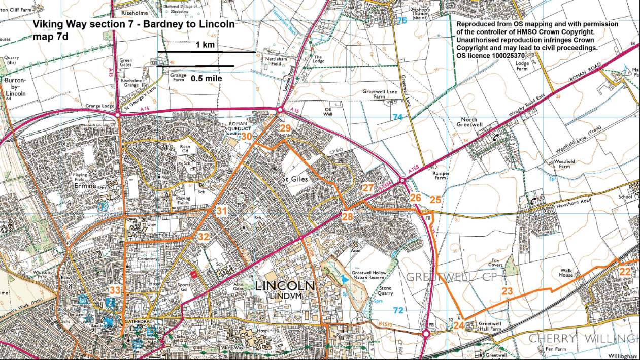
- 29Turn left, walk past the shops to the traffic lights.
- 30 Turn left to another set of traffic lights. Continue straight on along Nettleham Road to a roundabout.
- 31Again continue straight on along Nettleham Road for another 350 metres.
- 32Turn right onto Broadway. At the end of Broadway at a T-junction turn left.
- 33 Where the road bends to the left bear right to walk past the Roman Arch. Continue straight on along Bailgate to Castle square.