walking
The King Charles III England Coast Path
When it is completed, the King Charles III England Coast Path will be the longest managed coastal walking route in the world. The 2,700 mile coast path (4,500km) will encircle the entire English coastline, taking in beaches, clifftops, cities, nature reserves and harbours through a range of unique landscapes and natural environments, with all the history and culture they have to offer. Sections of the King Charles III England Coast Path are already open, and further sections around the country such as in Lincolnshire will complete in the next few months.


Lincolnshire's coastline, what’s it like?
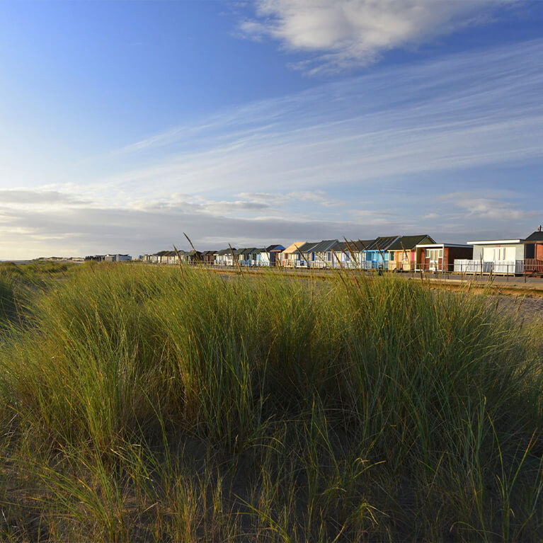
The biggest of skies and the widest of beaches. A long sweeping coastline backed by coastal marshes and the unspoilt rolling hills of the Wolds. The Lincolnshire coast is not as well-known as it should be. For example Gibraltar Point, a nature reserve of international significance for its migrating birds, sits on the very edge of the hustle and bustle of the busy Skegness resort. Resorts like Skegness and Cleethorpes are very popular and attract large numbers of visitors, but much of the coastline consists of vast unspoilt sandy beaches and nature reserves that are little visited.
The Greater Lincolnshire coastline forms part of the North East section of the KCIIIECP. When completed the total stretch of the KCIIIECP in Greater Lincolnshire will be 200km/124 miles. It will run from the Humber Bridge in the north to Cross Keys Bridge in the south.
Perfect for nature lovers the Lincolnshire coastline is located on the East Atlantic Migration Flyway and is one of the premier birdwatching areas in the UK. Huge whirling flocks of waders in the autumn, skeins of brent and pink footed geese in the winter and reed beds that are home to bitterns, bearded tits and marsh harriers and an assortment of migrating birds.
Ancient churches like the little thatched church at Markby to the landmark Boston Stump in that fascinating medieval market town. There are spectacular new buildings too such as the North Sea Observatory at Chapel Point.
the path sections:
Sutton Bridge To Skegness
This is a quiet and remote walk which is largely dominated by sea embankments, with salt marsh towards the sea and flat farmland landward which is all reclaimed from the sea. From Sutton Bridge the coastal path heads along the River Nene towards the shores of the Wash once more. Along the way, you’ll pass two lighthouses – with the Guy’s Head lighthouse on this shore (and the Sir Peter Scott Lighthouse on the east shore). You'll explore parts of Boston and pass scenic views of Freiston Shore.

Skegness to Mablethorpe
The first stretch of the King Charles III England Coast Path completed in Lincolnshire is the 16 miles (26 km) between the two traditional seaside resorts of Skegness and Mablethorpe. This section of path sits mostly along the sea defences, with the occasional section on the beach, it runs from Skegness Pier to Mablethorpe North End Car Park.
Mablethorpe to Humber Bridge
The final section of the Lincolnshire King Charles III England Coast Path has opened - spanning from Mablethorpe to the Humber Bridge. This scenic stretch takes you along Lincolnshire’s dynamic coastline, through sandy beaches, salt marshes, and classic seaside charm. Whether you're after sea views, wildlife, or a peaceful walking route, this section of the path offers a memorable coastal adventure.

who developed the Coastal Path?
The delivery of the King Charles III England Coast Path (KCIIIECP) is being led by Natural England. The path is being opened in sections building on some of the best existing coastal paths and developing new ones, and will eventually link to coastal trails in Wales and Scotland.
Once complete in Greater Lincolnshire it will be managed by a partnership led by Lincolnshire County Council, and a National Trail Officer ‘on the ground’.
You can find out more about the wider trail and access rights on the National Trails website.
Details of the stretches that are opened, approved, under establishment works can be found at www.gov.uk