Walk
Loop
2.75miles
(4.43km)
1 hour
30 mins

Walking

Viking Way Shorts Woolsthorpe by Belvoir

Woolsthorpe by Belvoir is a small village on the banks of the River Devon and on the Lincolnshire/Leicestershire border. Belvoir Castle sits majestically overlooking the village.

This walk will use a stretch of Grantham Canal towpath and a section of the Viking Way along an ancient drove road. 

On a clear day there are lovely views of the surrounding countryside and on the last section back to the village there are fantastic views across the Vale of Belvoir.

Starting point:
Village Shop
Main Street
Woolsthorpe by Belvoir
Grantham
NG32 1LY

Grid reference: SK 837 341 

  • RefreshmentsRefreshments

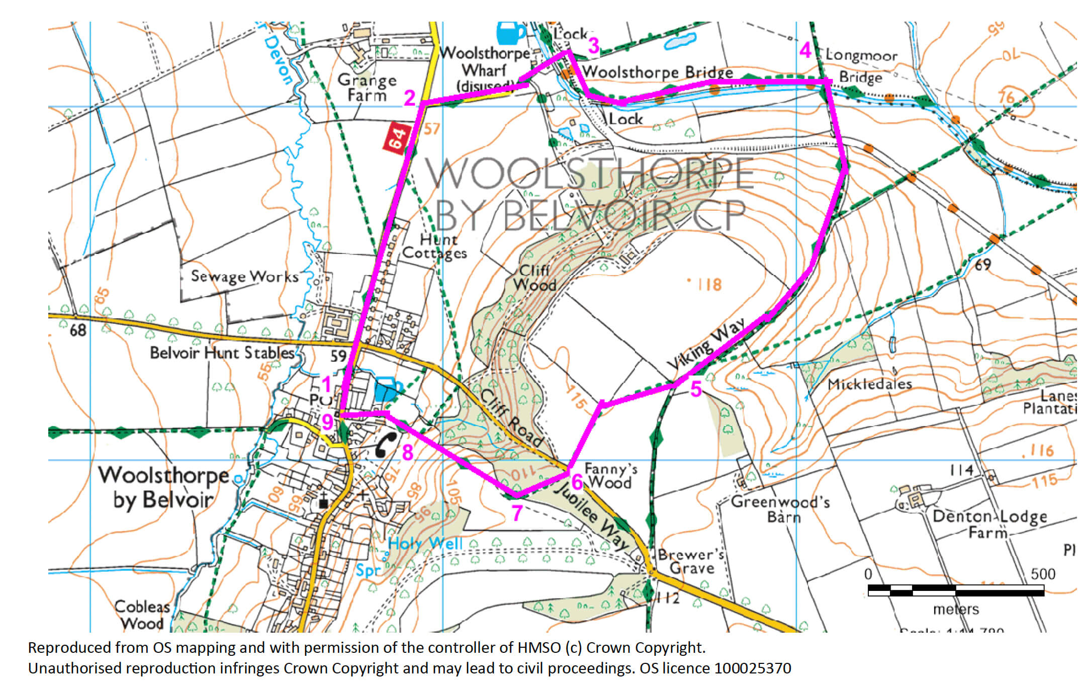
In 1879 the Stanton Iron Company began mining in the area for ironstone. The stone was transported by rail on a specially constructed branch line of the Great Northern Railway. Mining stopped after the First World War at Woolsthorpe but continued in adjacent parishes of Harston, Knipton and Denton. The branch line crossed Longmoor Lane (now the Viking Way) and the walk passes what remains of the bridge abutments. 

The Grantham Canal is 33 miles long and links Grantham to Nottingham and has 18 locks. Opened in 1798 its heyday was in the mid-19th century but the arrival of the railway took business away and in 1936 the canal closed. Ownership was transferred to British Waterways (now the Canal and River Trust) in 1963. The section used on this walk holds water and is navigable but some stretches of the canal remain dry. For more information go to the Grantham Society website.

As you walk along this uphill section of the Viking Way along Longmoor Lane, look out for the lovely old trees that line the route. These oak and ash trees are hundreds of years old and provide food and shelter for a wide variety of wildlife.

  • 1With your back to the Village shop turn left and follow the roadside path straight ahead for 900m to a lane and restricted byway on the right, signed to the Rutland Arms pub (also known as the Dirty Duck)
  • 2Turn right towards the pub and walk over the Grantham Canal using the red brick humpback bridge.
  • 3Just after bridge turn right onto the canal towpath and Viking Way. Follow the towpath for 800m to a red brick bridge over the canal (bridge no. 62).
  • 4Turn left just before the bridge and then right to cross the bridge and canal to continue along the Viking Way. This stretch being known as Longmoor Lane. Continue straight ahead along this lane for 1km ignoring a bridleway and then a footpath on the left.
  • 5Bear right onto a footpath and follow it across the field to a gap in the far hedge and road.
  • 6Cross the road and follow the footpath opposite through an area of trees to a stile.
  • 7Climb the stile and turn right to follow the field edge beside the woodland. At the end of the trees continue straight ahead to a stile in the hedge. Look out for the top of Woolsthorpe church tower as you walk down the hill and Belvoir Castle on the ridge ahead.
  • 8Climb the stile and walk straight on towards and then past the pub and into Woolsthorpe village and a road junction.
  • 9Turn right to the walk starting point.

The walk uses a mixture of surfaced paths, canal towpath, tracks and field paths. There are stiles and you may encounter livestock.                                

more information

Starting point:

Village Shop

Main Street

Woolsthorpe by Belvoir

Grantham

NG32 1LY

Grid reference: SK 837 341 

more about the trail

Viking Way

The Viking Way is a long distance - 147 mile way-marked trail spanning from the River Humber through Lincoln to Oakham in Rutland. The route is signposted with an icon of a Viking helmet on a yellow disk.