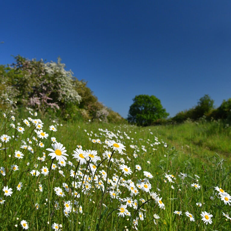
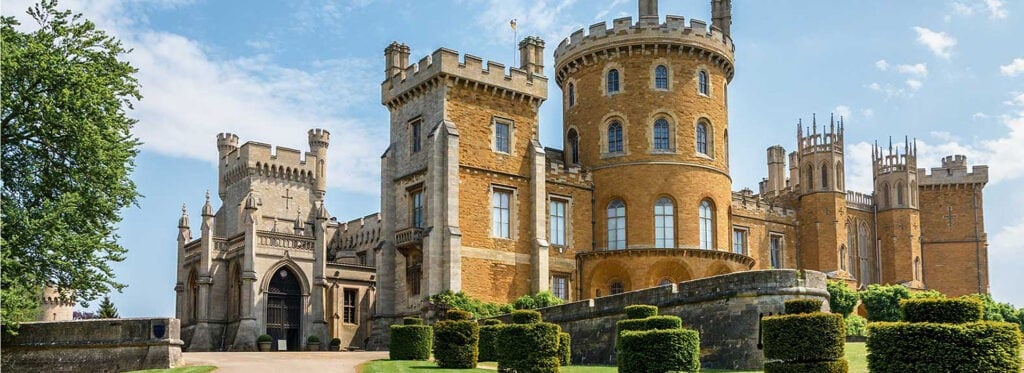
Walk
Linear
10miles
(16.09km)
5 hours
15 mins

Walking

Viking Way 12 Woolsthorpe To Sewstern Walk

Woolsthorpe,Sewstern

Starting on the canal towpath the route that follows ancient drove roads to Sewstern. Much of the route runs along the boundary between Lincolnshire and Leicestershire.

Starting point
Rutland Arms
Woolsthorpe by Belvoir
Grantham
NG32 1NY

  • ParkingParking
  • Cycle friendlyCycle friendly
  • RefreshmentsRefreshments
  • Dog FriendlyDog Friendly

Points of interest:

Saltby Airfield was built during the Second World War and now used as a gliding club.

Grantham Canal is 33 miles long and links Grantham to Nottingham. This section is navigable but other sections are dry.  It’s a great place to spot wildlife.

The Drift is an ancient track way. In places it forms the border between Lincolnshire and Leicestershire. The section between the A607 road and Saltlby Airfield is designated a Site of Special Scientific Interest (SSSI) as it is one of the best examples of limestone grassland in Lincolnshire. It is a carpet of colourful wildflowers in the summer months.  

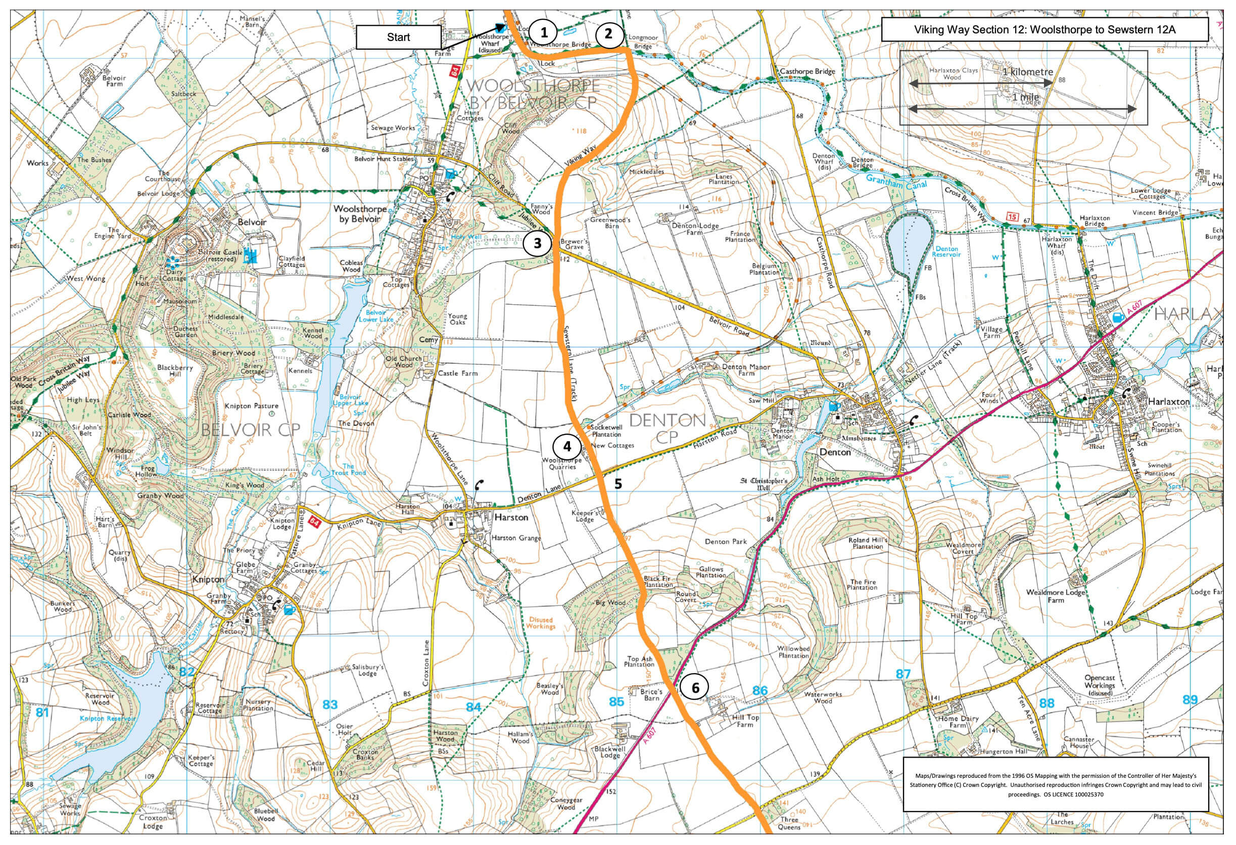
  • 1Continue along the canal towpath for approx. 0.5miles (800m) to Longmoor Bridge (bridge 62).
  • 2Leave the towpath here and turn right to cross the bridge and continue ahead along the bridleway for approx. one mile (1.6 kilometres) to a road.
  • 3Cross the road and continue along the bridleway opposite. Continue along the bridleway for approx. one mile (1.6 kilometres) to the cottages.
  • 4Continue straight ahead along the lane to a road.
  • 5 Cross the road with care and continue straight ahead through the woodland to a road (A607).
  • 6Cross this busy road with care and continue ahead. As the lane bends to the left in front of the cottages continue straight on along the grass lane, known as The Drift, to a road.
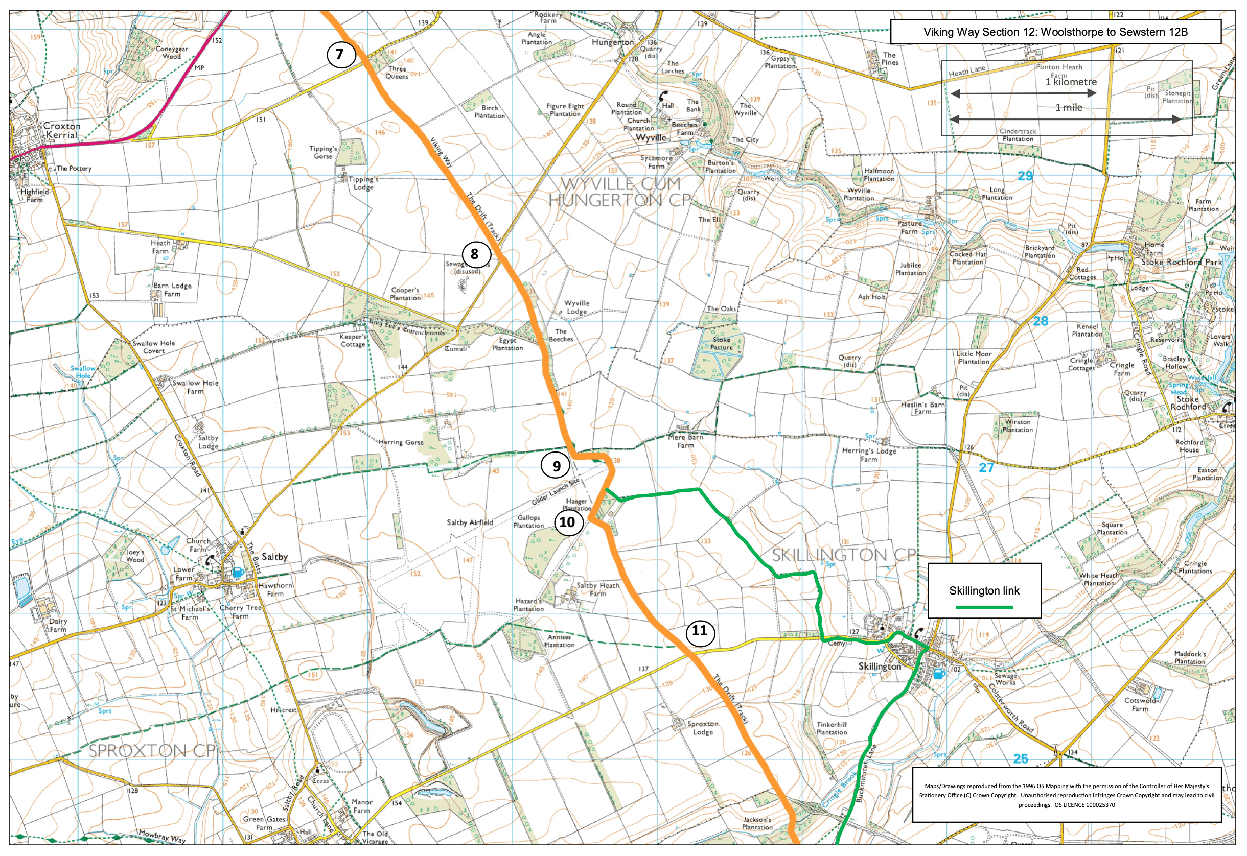
  • 7Cross the road and continue along The Drift to another road approx. one mile (1.6 kilometres).
  • 8At the road walk straight ahead along the road for approx. 80m before leaving the road to continue straight ahead along The Drift.
  • 9At the end of The Drift, approx. another mile (1.6 kilometres). Bear left along the footpath and taking care, walk across the end of the Buckminster Gliding Club runway (Saltby airfield).
  • 10Follow the footpath and road straight ahead, past the end of the building, and at the end of the area of trees turn left to walk past the Saltby Airfield Memorial. Continue along the concrete road past the gliding club building and then straight ahead as it becomes a grass track. Follow it for 0.75 miles (1.2 kilometres) to a road.
  • 11Cross the road and continue along the grass track, still The Drift, for another 1.4 miles (2.2 kilometres) to a road junction next to a water tower.
  • 12Continue straight ahead along the road to a crossroads.
  • 13Continue straight on, signed Sewstern, taking care crossing the road. Follow the road into Sewstern village.

Link to Skillington village:

After crossing the end of the runway at Saltby airfield turn left just past the hanger and walk along the concrete area. At the end of the hanger bear left along the footpath which follows the field edge.

Follow the path around the field edges and as it becomes a track. After approx. one mile (1.6 kilometres) from the airfield turn left off the stone track onto a grass path. Follow the path as it bends left and then reaches a road.

Turn left and follow the road into Skillington village.

To rejoin the Viking Way: At the crossroads in the centre of the village turn right, continue straight on along Buckminster lane, which becomes a track and public footpath.

Follow the track for approx. one mile (1.6 kilometres) to a junction with another track. Turn left to re-join the Viking Way.

The route uses canal towpath, tracks and roads. The busy A607 road is crossed once. There are no stiles, and you are unlikely to encounter livestock.

more information

Starting point

Rutland Arms

Woolsthorpe by Belvoir

Grantham

NG32 1NY

more about the trail

Viking Way

The Viking Way is a long distance - 147 mile way-marked trail spanning from the River Humber through Lincoln to Oakham in Rutland. The route is signposted with an icon of a Viking helmet on a yellow disk.