Walk
Loop
3.75miles
(6.04km)
2 hours

Walking

Burgh Le Marsh Long Walk

Burgh le Marsh

Lying between the coast and the Wolds, the grazing marshes are a nationally threatened habitat supporting a rich variety of wildlife with a distinctive landscape and cultural history. This walk is set in Burgh le Marsh and farmland to the west of this small town. Burgh is built around a low hill in the southern “Middle Marsh”. This is part of the Lincolnshire coastal plain, where during the last Ice Age, clays and rocks were spread over the eastern edge of the chalk wolds. This has produced deeper, moister soils, where there is still a high proportion of grassland. The fields, their hedges, trees, drains and ditches collectively still support a wide range of farmland birds, such as lapwing, skylark, tree sparrow and fieldfare.

There is evidence from the Domesday Book of an important Anglo-Saxon settlement here called Burg or Burch meaning ‘fort’.

Burgh le Marsh was granted a charter in 1401 and became a busy market town with the surrounding marsh area providing good grazing for cattle. The town market was located on the High Street. The market closed in 1961.

The Parish Church of St Peter and St Paul was built around 1500 with later alterations and additions. The clock on the tower has an ornate painted surround and was originally intended to be in the town’s market place.

Dobson’s windmill, a prominent feature of the town, was built in 1813 and restored in 1947. It is named after Frank Dobson the last miller, who worked there until 1964. The windmill has five sails and stands five storeys high. At the other end of the town is Hanson’s mill which was built in 1855 and was in use until the 1930s. The machinery was removed in 1964 and taken to Brixton Mill in London.

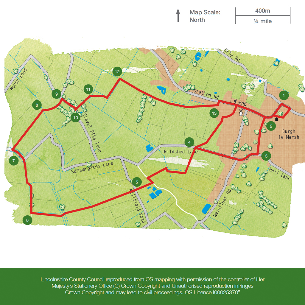
Starting point: Market Place, Burgh le Marsh, PE24 5JW.
Grid reference TF 501 651.

  • ParkingParking
  • Linked to Public TransportLinked to Public Transport
  • RefreshmentsRefreshments
  • Dog FriendlyDog Friendly

The mound in the field on your right, between points 2  is the site of an Anglo-Saxon burial mound and ditch. It was excavated in 1933 and found to contain a burial from the late 6th or early 7th century. It is thought the mound was enlarged and used for cock fighting, hence its name Cock Hill. The mound is a designated Scheduled Monument.

As you walk away from the town you will see evidence of the traditional farming systems with a mix of small and large fields and grazing marsh used to fatten cattle. Land around Burgh le Marsh would have been reclaimed by man for this purpose.

The area, between points 10 and 11, is owned by Burgh le Marsh Town Council and is managed as an area for wildlife. Look out for the pond on the right which was formed from old gravel workings.

The lumps, bumps and ditches in the last field before point 13 are remnants of the shrunken medieval village of Burgh le Marsh.

  • 1Leave the Market Place, turn left and cross the High Street in front of the Bell Inn and walk up Church Street past the Museum and Library. Follow the path diagonally across the churchyard.
  • 2Leave the churchyard, turn left and take the public footpath on the left just before the path rises. Keep straight ahead on this path until you reach a road.
  • 3Turn right and follow the road At the road junction turn right, then left along Wildshed Lane. After approx 250m there is a public footpath on each side of the road.
  • 4Turn left and walk beside the hedgerow to the end of the field. Cross the bridge, turn right and follow the hedgerow and ditch to the field corner. Turn right and then immediately left and cross the field to the left of the house. Cross into the next field and walk between the ponds. Continue ahead between the house and bungalow to reach a road.
  • 5Cross the road and follow the footpath opposite by bearing left to the corner of the field. Cross the next field by bearing slightly right, taking care through this marshy field, to reach the first of three footbridges. Cross the bridges and walk straight on along the edge of the field to a green lane.
  • 6Turn right and follow the lane to a road.
  • 7At the road turn left and after approx 100m turn right onto a public footpath. Cross the field by bearing slightly right to a footbridge and footpath sign that will come into view.
  • 8Cross the bridge and walk straight ahead across the field to a stile. Bear slightly right to cross the next field to a road.
  • 9Turn right and after approximately 100m turn left onto a public footpath.
  • 10Follow the path with the ditch and then hedgerow on your right for approximately 150m.
  • 11Follow the path through the first large gap in the hedge and cross the field by bearing diagonally left to the hedge and then follow the hedge to the field corner. Turn left and follow the path beside the ditch. Keep your eyes open for water voles.
  • 12At the footpath sign turn right and follow the hedgerow Continue straight on along the track. At the junction with another track continue ahead in the same direction. Follow the track into the field and bear left towards the fence and old windmill. Go through the hedge and bear left to the corner of the orchard and down a narrow path to a road.
  • 13Turn left, and at the main road turn right, past Hanson’s windmill. Follow the roadside path back to the Market Place.

This walk uses roadside pavements, field paths and quiet roads.  There may be stiles.  You are likely to encounter livestock.

more information

Starting point: Market Place, Burgh le Marsh, PE24 5JW

Grid reference: TF 501 651