


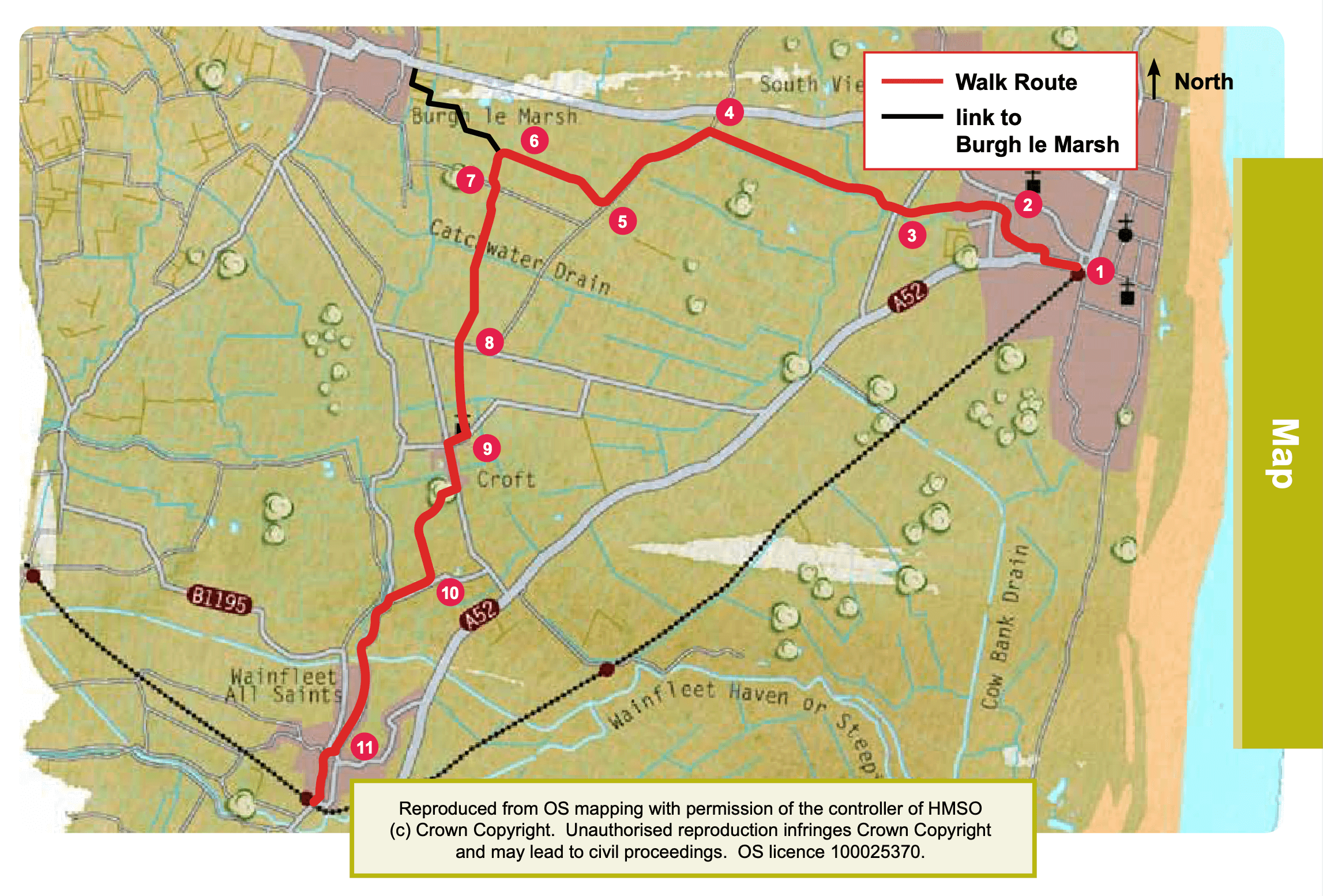
- 1Leave Skegness railway station and turn left. Cross the road at the pedestrian crossing and turn right along Grantham Drive towards the Church Farm Museum. Take the first left along Old Wainfleet Road and continue straight on as it becomes Church Road South.
- 2As the road bends to the right and about 50m before Swaby Crescent turn left along a public footpath. Follow the footpath between houses to a road. Cross the road and continue straight on along the footpath. As the path emerges from the housing area, walk along the field edge beside the drain to a bridge in the hedge. Cross the bridge and continue straight ahead across the field heading to the right of the house, to a bridge and road.
- 3Turn left and follow the road for approximately 30m before turning right along a public footpath. Bear right across the field to a metal footpath sign beside the drain. Continue along the footpath beside the drain for approximately one mile (1.5 kilometres).
- 4At the road turn left - follow the road for approximately 0.75 miles (one kilometre).
- 5Turn right onto public footpath and bear across the field to the corner and a bridge. Cross the bridge and turn left, following the path beside the drain for 0.5 miles (0.75 kilometres) to a bridge.
- 6At the bridge two public footpaths meet - to go to Burgh Le Marsh from this point it is approximately just over 0.75 miles(1.3 kilometres) each way along the same route. To continue on the route towards Wainfleet turn left and cross the bridge and walk straight across the field heading to the left of the house.
- 7At the road turn left and after 50m turn right onto a public footpath. Bear slightly left across the field, heading to a bridge and the tower of Croft Church. Cross the bridge and follow the footpath straight on keeping the drain on your right. Cross the bridge over the Catchwater Drain and continue straight on, keeping the smaller drain on your right. Cross another bridge and as the drain bends to the right, bear slightly to the left heading left of the church tower across the field to a bridge in the field corner. Carry straight on along the field edge and drain.
- 8 At the road turn right and then almost immediately left along the footpath towards Croft Church. The footpath follows the field edges beside the drain, crossing three bridges before it leads to a road.
- 9Turn right and follow the road into Croft, past the village hall and All Saints’ Church. At the road junction by the memorial cross turn left and after approximately 400m turn right onto the public footpath signed to Croft Road. Walk beside the drain until it bends to the right - at this point bear diagonally left across the field to the bridge in the hedgeline. Cross the bridge and turn right to a bridge in the field corner. Cross the bridge, turn left and follow two field edges to a bridge and footpath sign. Follow the sign to Croft Road, heading towards the corner of the wood. Go through the gap between the hedge and the trees and follow the path through a garden to a road.
- 10Turn right and at the T-junction turn left. Follow the road for approximately one mile (1.5 kilometres) to a T-junction.
- 11Turn right and at the next T-junction turn left along the High Street. Follow the High Street past the Market Place and onto the railway station.