


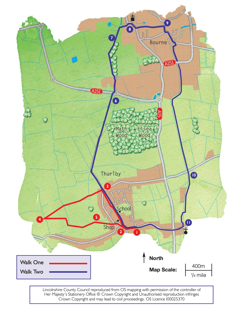
- 1Turn right onto the High Street and follow it as it bends to the right.
- 2As it then bends to the left, turn right onto Crown Lane, towards the school and community centre. Continue straight ahead along the path, keeping the school on the right. Keep straight on past the rear of some houses and follow the path to a road. Cross the road and continue straight ahead along a public footpath. Walk the length of the field to a road. Cross the road, past the grass triangle, and walk along Wood Lane. Continue along Wood Lane until it forks. Take the right-hand lane and follow it until it becomes a footpath, which runs alongside the old railway line, to a road.
- 6Cross the road with care and follow the public footpath directly opposite. At the 2nd smaller roundabout (by the playground) bear left and cross the road and follow the public footpath ahead through the spinney. Follow the path along the edge of the spinney for approximately 300m. As the path emerges from the trees turn right, and follow the path.
- 7After approximately 200m turn right through a gate and follow the path diagonally left across the field to another gate. Follow the path to the right alongside the water, through Baldock’s Mill arch to South Street.
- 8Cross the road with care and turn right, past the church of St Peter and St Paul, which was built as part of a priory for Augustinian canons in 1138. Turn left along Coggles Causeway and follow it to its end. Carry straight on and follow the footpath, with the playing field on the left, to the junction with Victoria Place. Continue straight on to Willoughby Road junction.
- 9Turn right and at the next junction turn left and follow the road for approximately 230m to a public footpath on the right alongside a dyke, the Car Dyke. Follow this footpath alongside the Car Dyke, taking care crossing Cherry Holt Road. Follow the path alongside the Dyke for approximately one mile (1.6 kilometres) to Northorpe Fen Road.
- 10Cross the road and continue to follow the path alongside the Dyke as far as you can to the Manor House. Cross the footbridge over the Dyke and turn left. Cross the lane and continue along the footpath ahead to St Firmin’s Church, named after a little known saint who was the first Bishop of Amiens.
- 11Turn right and follow the road to the A15. Use the pedestrian crossing to cross the road and walk along Thurlby High Street opposite, to return to the Methodist Church.