


- Begin at Mablethorpe North End, following the waymarked path to Crook Bank Car Park. From there, pass Theddlethorpe Dunes to reach Sea Bank Farm, then continue through the dunes to Cloves Bridge and on to Sea View Farm.
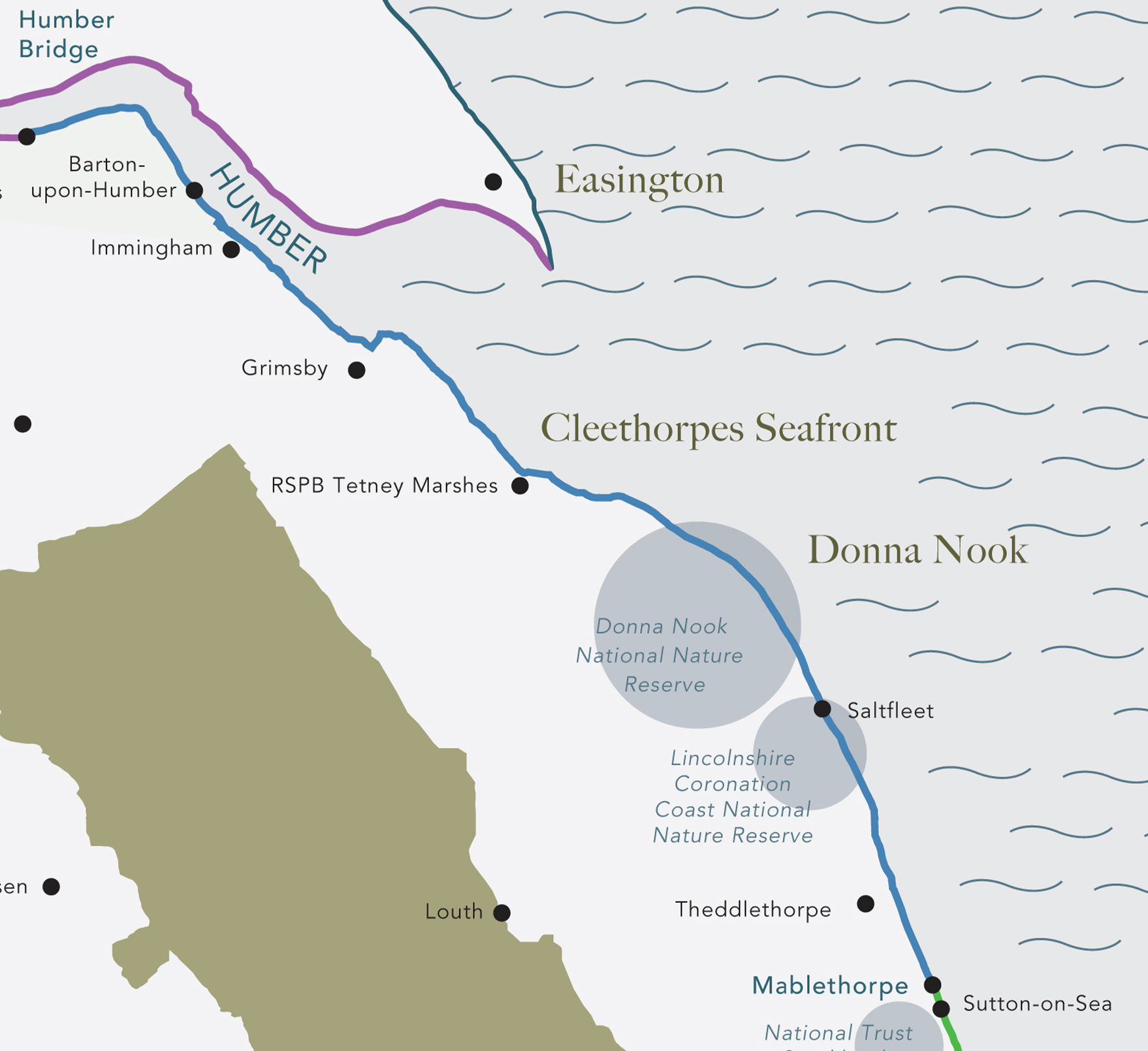
- Proceed to Saltfleet Haven, continuing past Donna Nook National Nature Reserve (on your right) to Marsh Lane, then on to Salt Marsh, Red Farm Track, and Coastguard Lookout. Follow the path past Donna Nook again to Stonebridge Cottages, reaching the Fitties, and continue through Somercoates Haven to Grainthorpe Haven.
- Head straight on to Horse Shoe Point, passing North Coates Airfield to reach Northcoates Point, then on to Tetney Haven and Tetney Marsh Nature Reserve. Continue past the golf course (on your left), veering right to Humber Mouth Yacht Club, and move past Humberston Fitties Holiday Camp and Thorpe Park Caravan Park to arrive at North Sea Lane Car Park.
- From here, head to Lakeside Central, passing the Tropical Butterfly Garden and Miniature Railway, to reach Cleethorpes Central Promenade. Continue to Wonderland, then on to New Clee Station, passing Blundell Park football ground.
- Continue through Corporation Bridge to Moody Lane, and then head in a straight line to Novartis, Old Fleet Drain, Middle Drain, and North Beck Drain. Turn inland toward Queen’s Road, then proceed to Manby Road in Immingham, continuing on to Houlton’s Covert and Marsh Lane.
- Follow the route past Killingholme Marshes to North Killingholme Haven, Halton Marshes, East Halton Skitter, and East Marsh, reaching Skitter Ness. From there, continue through Goxhill Haven and Goxhill Tileries, then straight to New Holland Mere and onward to Wilban House, passing Fairfields Pit Nature Reserve.
- Next, head to Barrow Haven Reedbed, past North Lincs Sailing Club, and through Pasture Wharf Nature Reserve. Follow the final stretch past Waters' Edge Country Park to Barton Waterside, and complete the route by crossing the Humber Bridge.

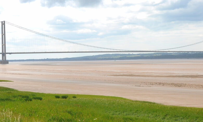
Humber Bridge
Visible as a landmark for miles round, the Humber Bridge is Grade I listed, recognised for its architectural significance. Completed in 1981 this 2.22km (1.38m) single span road suspension bridge crosses the Humber Estuary with four lanes of traffic and has pedestrian and cycle paths on either side.

Water’s Edge Country Park
Water’s Edge Country Park and the adjacent Far Ings Nature Reserve both have the mighty Humber Bridge as a backdrop. Far Ings is good for spotting bittern and marsh harriers. Water’s Edge has woodlands, wildflower meadows, ponds and a visitor centre.

Far Ings Nature Reserve
Water’s Edge Country Park and the adjacent Far Ings Nature Reserve both have the mighty Humber Bridge as a backdrop. Far Ings is good for spotting bittern and marsh harriers. Water’s Edge has woodlands, wildflower meadows, ponds and a visitor centre.
Barton Upon Humber
Barton Upon Humber is an historic market town at the southern end of the Humber Bridge. It has two medieval churches, St Peter’s and St Mary’s located just 170 yards apart. Anglo Saxon St Peter’s is the older of the two.

Grimsby
The Grimsby Dock Tower (1852) at the entrance to the docks was based on a tower in Siena, Italy, its intricate design conceals a gigantic water tank. It provided the water pressure to power the machinery of the docks. Grimsby Fishing Heritage Centre is an award winning attraction with original trawler interiors which takes you back to the 1950’s heyday of this famous fishing port.

Cleethorpes
Cleethorpes was developed as a Victorian coastal resort, today Cleethorpes Pier houses the ‘world’s biggest fish and chips restaurant’. The seafront at Cleethorpes includes a Ramsar site and Special Protection Area for migratory birds, making it a very accessible area for birdwatching.

The Greenwich Meridian
The Greenwich Meridian passes through Humberston, where the Fitties can also be found. The Humberston Fitties were developed during the 1920’s after the First World War, when the area was divided into plots which were characterised by haphazard development. Buildings were constructed using inexpensive materials resulting in some very individualistic structures. The Fitties holiday chalets are now a conservation area.

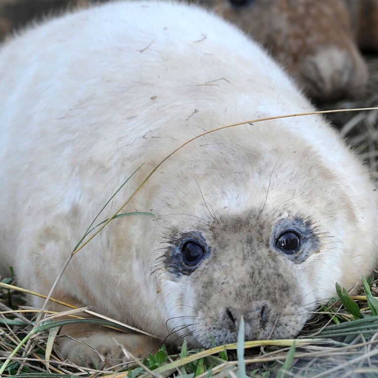
Donna Nook
The reserve at Donna Nook has a thriving colony of grey seals who in the winter months come on land to give birth. Over 2000 pups were born in 2023.

Lincolnshire Coronation Coast National Nature Reserve
Lincolnshire Coronation Coast National Nature Reserve has now become two thirds larger than the original reserve and one of the largest in England. It has always been noted for its wild flowers – orchids, sea lavender, thrift and sea buckthorn, but also migrant birds and the rare natterjack toad.