(9.66km)
Walking
Mumby To Hogsthorpe Walk Two (Inns on the Edge)
Mumby,Hogsthorpe
Mumby is situated on the A52, 14.5 kilometres (nine miles) north of Skegness in the Lincolnshire Coastal Country Park.
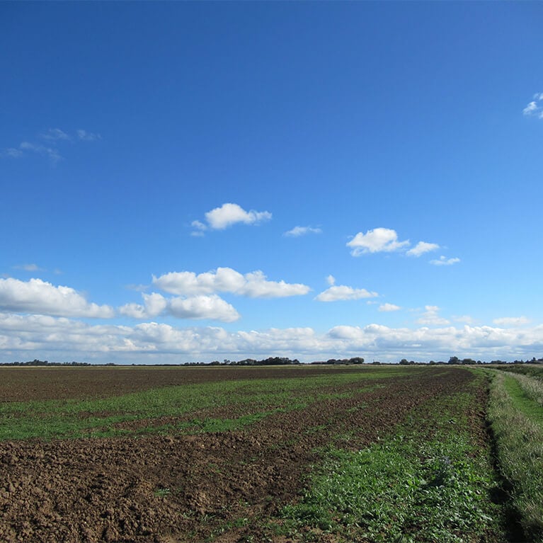
The villages of Mumby and Hogsthorpe lie within the Lincolnshire Coastal Country Park (LCCP) a few miles inland from the coast. Mumby’s origins date back to the Anglo-Saxon period and Hogsthorpe was first recorded in the 12th century.The walk will take in both villages and the countryside between them.
The Coastal Country Park stretches along the coast from Sandilands to Chapel St Leonards, and inland to Hogsthorpe, Mumby, Anderby and Huttoft. There are miles of stunning sandy beaches, wildlife packed nature reserves and varied attractions including the North Sea Observatory, Cloud Bar, Round and Round House and Sound Tower.
Starting point
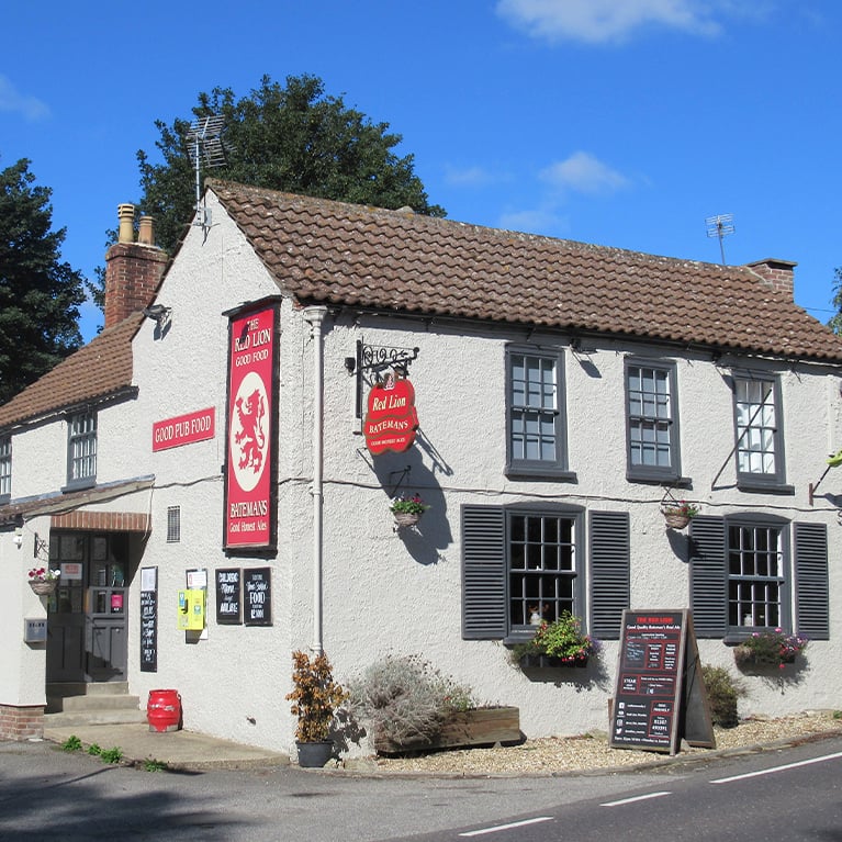
Red Lion pub
Hogsthorpe Road
Mumby
LN13 9SD
Refreshments
Dog Friendly
This walk was developed as part of the Inns on the Edge Project. The project was funded by Historic England to look at the significance of rural pubs along the Lincolnshire coast. As well as researching the history of these valued historic pubs the project will also look at the pressures on these businesses and the opportunities for them to thrive and innovate.
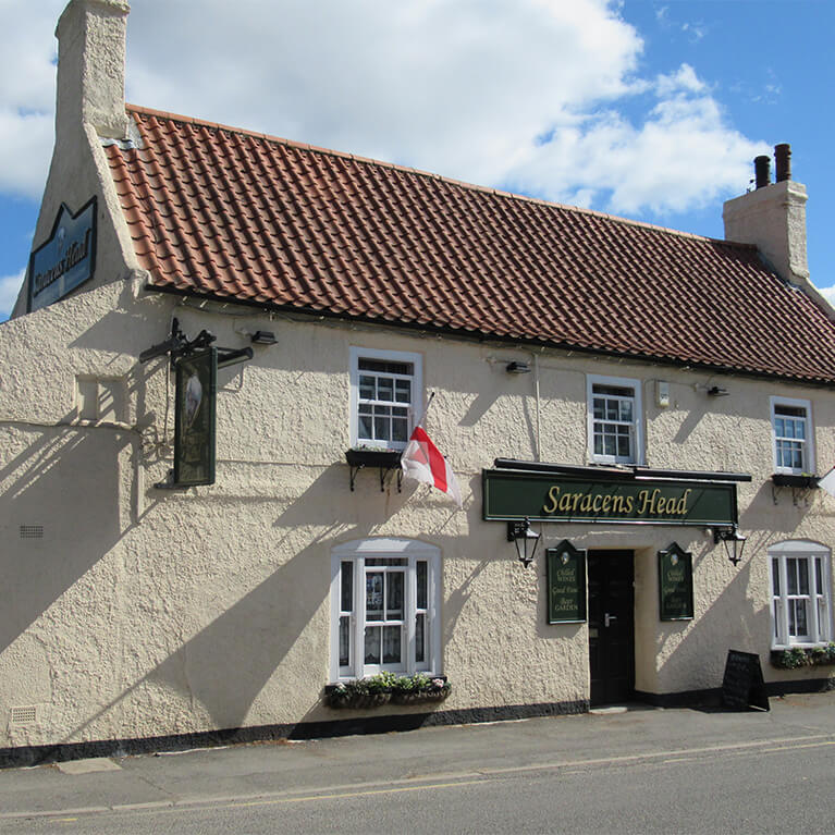
Saracens Head is a Grade II listed public house and dates from the early 18th century with alterations in the early 19th and 20th centuries. A landmark for locals and visitors, Saracens Head was a place where money frequently changed hands not for drinks - but property and livestock.
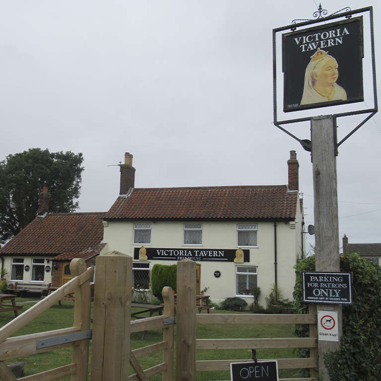
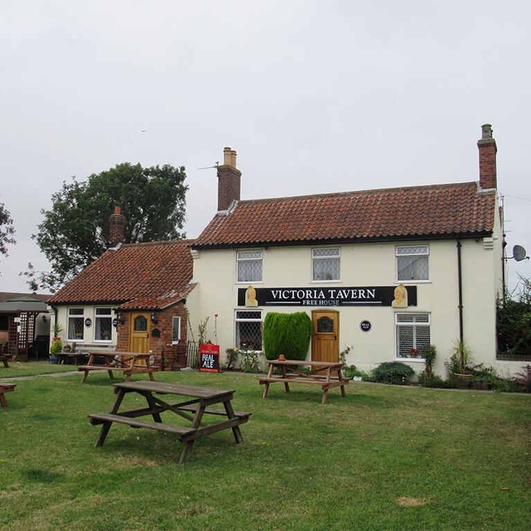
Originally a beerhouse, the Victoria Tavern has been serving customers since 1869. In 1909 it was one of 3 licensed houses in Hogsthorpe, the others being the Saracens Head and The Bell. In 1900, the licensee was William Parish and under him the pub was partly rebuilt. The alterations helped compete with The Bell and Saracens Head as a place to stay for visitors.
The Red Lion has been the focal point of the village since the 18th century and would have served as a staging post for those travelling to and from the coast. Inside, the pub retains much of its original charm with a traditional seating layout, exposed ceiling beams and period brick fireplace. Over 400 pubs share the same name as the Red Lion, making it the most popular pub name in England.
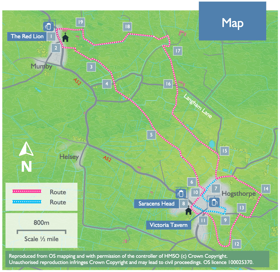
- 1With your back to the pub turn right. Cross the main road (A52) with care and follow the road/layby in front of the church.
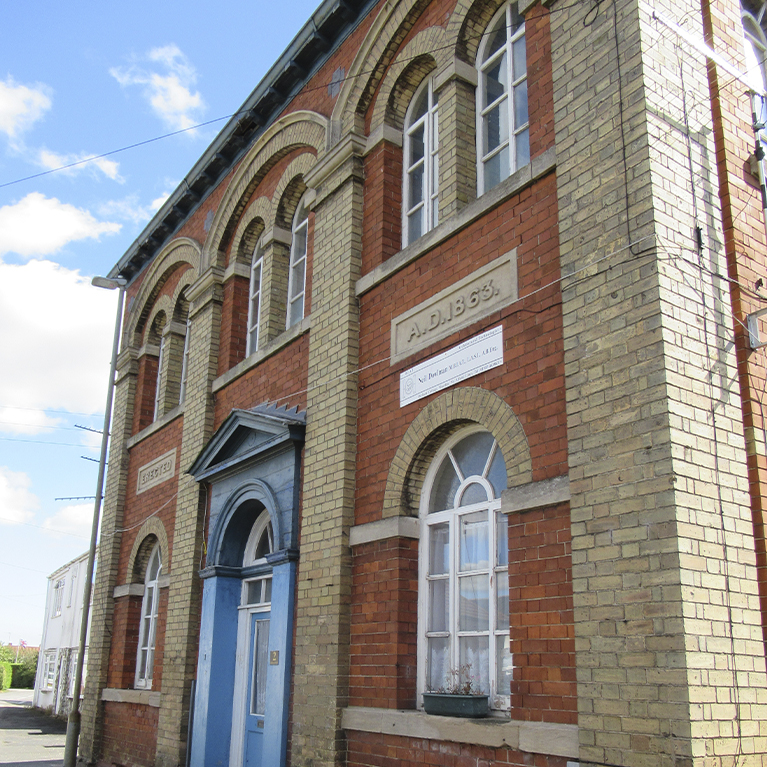
- 2Take the public footpath on the left adjacent to the old Methodist chapel. Cross the bridge and follow the path to the right, between a hedge and fence. Cross another bridge and turn left to follow the path between hedges to a bridge.
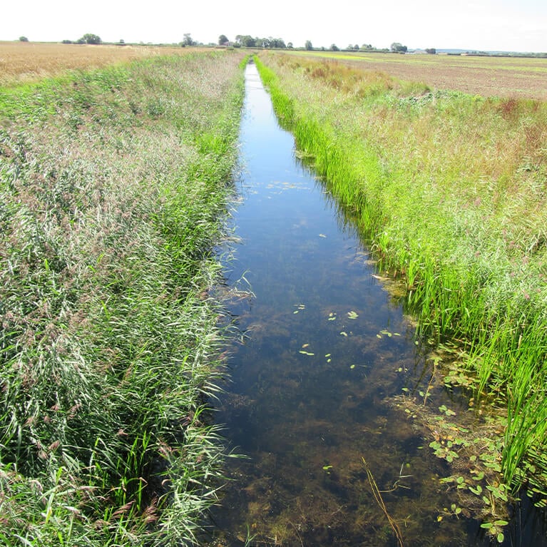
- 3Walk straight across the field to a waymarker post next to a drain. Turn left and follow the field edge and drain to a bridge.
- 3Cross the bridge and walk straight on alongside the drain. At the end of the field carry straight on over the bridge and follow the path straight on to a road. Cross the road and follow the public footpath straight ahead across a field to a bridge in the hedge. Cross the bridge and follow the path ahead along the field edge. At the field corner cross the bridge and track and continue straight on across the middle of the field to a bridge. Follow the path diagonally right across the field to the corner.
- 5Go through the hedge and bear diagonally right across the field corner. Go through the hedge and cross the field by bearing left to a bridge. Walk straight ahead beside the drain to another bridge. Continue on beside the drain. Cross another bridge and continue beside the drain, which is now on your left. Cross the farm bridge and continue ahead along the field edge. Bear left over a small bridge and walk straight ahead. At the field corner bear diagonally right to the corner of the metal fence.
- 6Go through the gate and along the edge of the playing field and past Hogsthorpe Village Hall to a road.
- 7Turn right and follow the road to a T-junction with the A52. Look out for the Saracens Head pub and the village information boards.
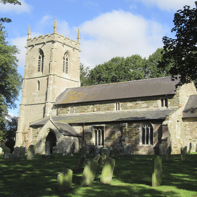
- 8Cross the road with care and follow the public footpath into the church yard. Follow the path past the tower and then to the left to a gate at the end of the wall behind a brick building. Cross the paddock by bearing left to a gate in the corner. Walk along the driveway to the road.
- 11Cross the road with care and follow the footpath opposite, at the side of the old methodist chapel. At the field bear diagonally left heading towards a bridge and the house in the distance. Cross the bridge and bear right to a fingerpost by a drain. Turn right and follow the field edge. At the trees turn right over the culvert bear left to follow the path to a drain. Walk straight across the field to a bridge.
- 12Don’t cross the bridge but turn left to follow the drain to a fence and fingerpost. Turn left to a track. Turn right and follow the track past allotments, to a road.
- 13Turn right and after approximately 100 metres turn left along a public footpath and follow it straight ahead along the field edge. Just before the gate into the building complex, turn right and then left to follow the path to a road.
- 14Turn left. Follow the road for approximately 700 metres and take the second road on the right, Langham Road. Follow the road for approximately 350 metres to where it bends to the right.
- 15Leave the road here to follow the No Through road straight ahead. Continue as it becomes a track and reaches a road, approximately 1200 metres (0.75 miles).
- 16Cross straight over the road to follow a public footpath slightly left across the fields, heading towards the house and barns. Cross over a culvert, to a gap in the hedge and a track.
- 17Turn right then almost immediately left to walk along the track towards a house, Wesley Farm House. After approximately 100 metres turn left onto a path across fields to a bridge. Cross the bridge and bear right to another bridge. Turn right then almost immediately left to walk alongside the drain, keeping the drain on your left.
- 18Turn left towards Mumby village. At the T-junction with the A52 turn left to return to the starting point.
The walk uses field paths, tracks and quiet lanes and may be muddy in places. You are likely to encounter stiles and livestock on this walk.
things to do in the area
Battle of Britain Memorial Flight Visitor Centre (BBMF)
Horncastle Pool & Fitness Suite
Lincolnshire Aviation Heritage Centre
Meridian Leisure Centre, Louth
Back 2 Bear Outdoor Activities
Bain Valley, Belmont Mast, Biscathorpe Lake Birdwatching
Covenham Reservoir Birdwatching
Donna Nook National Nature Reserve Birdwatching
Huttoft Bank Pit Nature Reserve
Lincoln & Witham Landscape Recovery
Red Hill & Stenigot Birdwatching
Saltfleetby Theddlethorpe Dunes
South Ormsby Estate Birdwatching
South Ormsby Estate’s Lincoln Red Beef
Willingham Forest & Linwood Warren Birdwatching
Alford to the Coast Cycle Route
Edge of the Lincolnshire Wolds – Market Rasen to Caistor Cycle Route
Edge of the Lincolnshire Wolds – Market Rasen to Wickenby Cycle Route
Lincolnshire Wolds Cycle Route
Lincolnshire Wolds’ Challenge Cycle Route
places to stay in the area
Longwool Lookout at the Rookery Rural Retreats
Louth Livestock Market Motorhome Stopover
Off-the-Grid Camping at Wykeham Hall Farm
Sycamore and Stars Off Grid Retreat
The Saddlehouse at Wykeham Hall Farm
The Stables at the Rookery Rural Retreats
Brackenborough Hall Coach House
Elmhirst Lakes Luxury Fishing Retreat
Galley Hill Farm Glamping and Camping
Greetham Retreat CL Touring Site
Grimblethorpe Hall Country Cottages
Katie’s Corner at Greetham Retreat
Laura’s Loft at Greetham Retreat
Maggie’s Mews at Greetham Retreat
Rose’s Rest at Greetham Retreat
The Half Moon Hotel and Restaurant
Wendy’s Wing at Greetham Retreat
Holme Lea Caravan & Camping Site (inc. Green Gables Luxury Wagon)
Otby House Farm Caravan and Camping Site
