


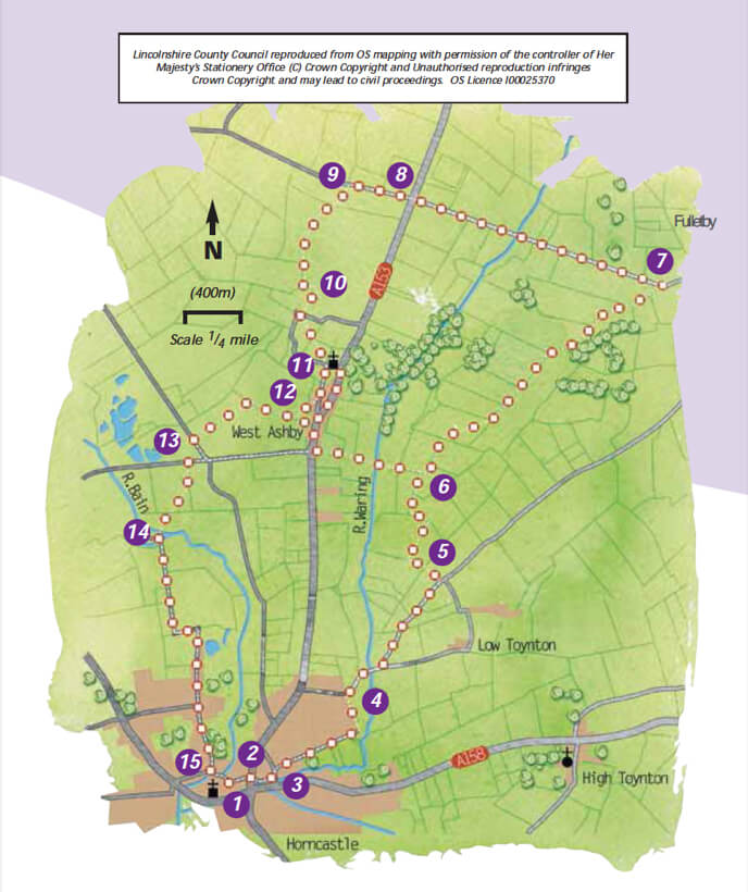
- 1With your back to the Post Office walk across the Market Place. Turn left along High Street to its junction with North Street and Bull Ring.
- 2Take Banks Street, the narrow street directly in front of you. At the end of Banks Street is the River Waring. Follow the river to a T-junction.
- 3Turn left and then take the next right, Bowl Alley Lane. Walk past the schools and where the road bends to the left, follow the waymarked lane that goes straight ahead behind the houses. Continue along this path as it turns left to reach a road.
- 4Turn right and walk along the road, taking the left fork to Fulletby.
- 5At the next road junction turn left onto the public bridleway. Follow the waymarkers and Viking Way signs as the bridleway turns right, left and then right again before meeting another bridleway.
- 6Turn right and continue along the Viking Way as it turns left, and then right alongside a hedge before joining a stone track past a farmyard to a road. To visit Fulletby turn right.
- 7To continue the walk, turn left and leave the Viking Way and walk along the road as it descends to cross the River Waring and then climbs to its junction with the A153.
- 8Cross the road with care and carry straight on to Farthorpe.
- 9At the bottom of the hill cross the stream and turn left onto a bridleway and farm road. After crossing the stream again, turn right into the trees along the bridleway beside the stream and ponds, and then on in the same direction along a field edge.
- 10 At the junction with a footpath, cross the bridge and bear right at a slight angle towards a bungalow where there is a gate in the fence. Turn left to follow the driveway to the lane. Turn right, and at the end of the lane turn left. Follow the footpath diagonally across the field towards a gate in a dog leg in the hedge. Cross the next field by bearing diagonally left to the corner of the field and end of the wall. Turn right through the gate and follow the path across the field, by keeping the hedge on your right, to the field corner and lane.
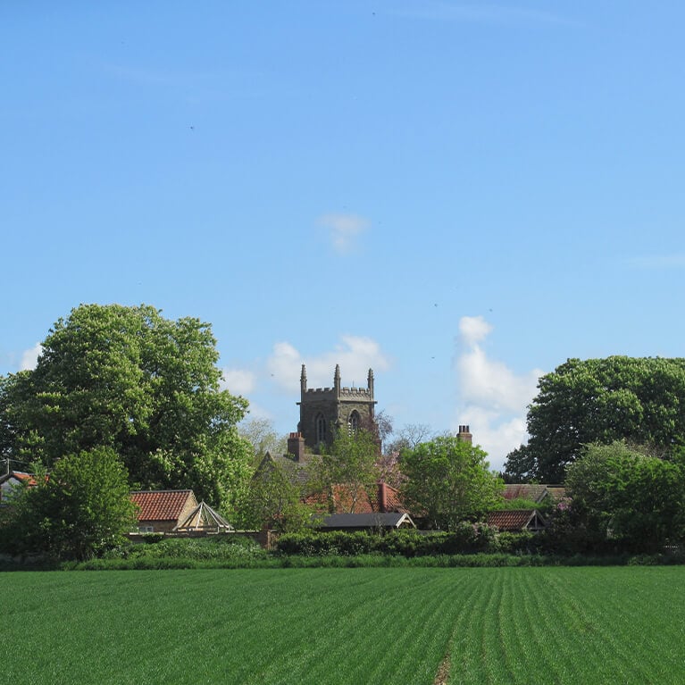
- 11Turn left along the lane. Leave the lane as it turns left past the church, and continue straight on along a track.
- 12At the end of the track take the footpath through a gate on the right. Turn left and follow the field edge to where the path goes left through the hedge. Turn right and follow the hedge, straight on and then left, to the road.
- 13Turn left and at the crossroads turn right. After approximately 150m turn left onto a public footpath which crosses two fields. Bear slightly right to a gap in the hedge. Continue diagonally right, to a bridge over the River Bain.
- 14Cross the bridge, continue straight ahead through a garden then past Thimbleby Mill and onto a lane.
- 15Follow this lane through the outskirts of Horncastle to a T-junction. Turn left to return to the Market Place.