


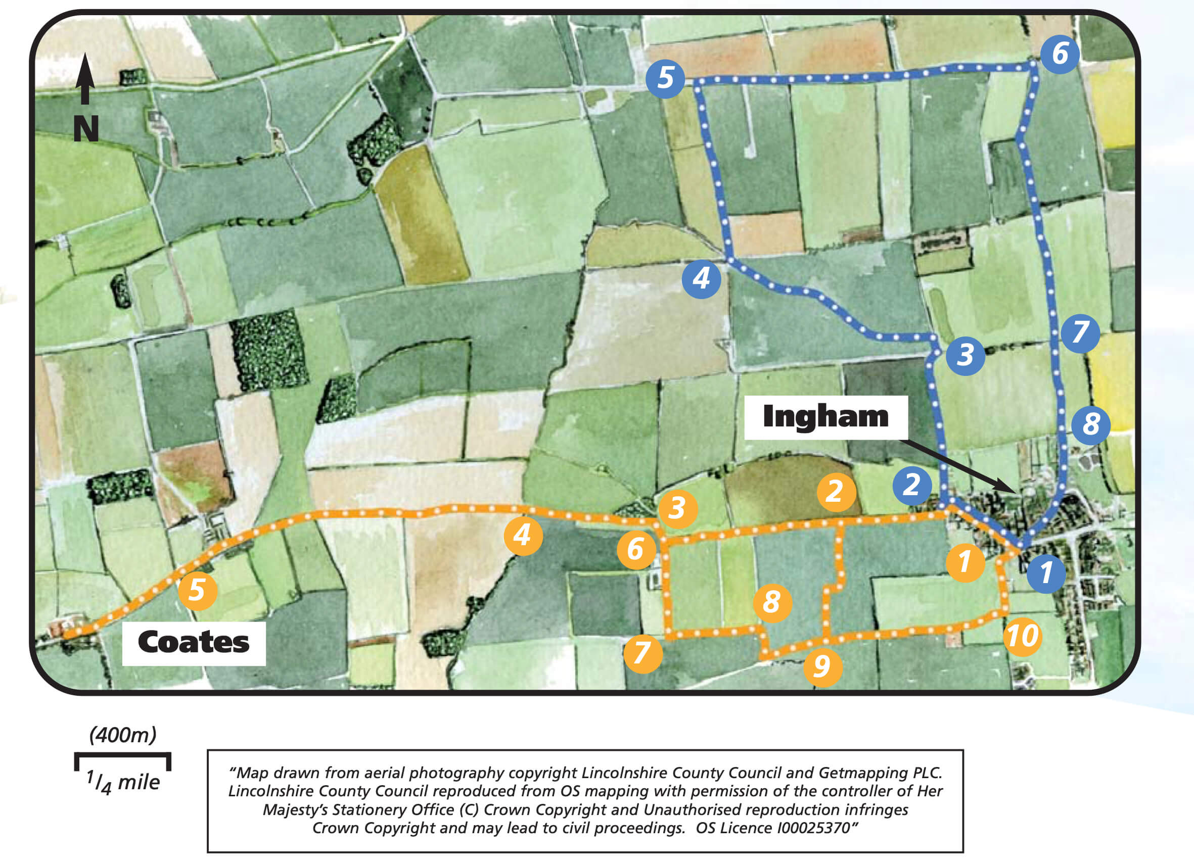
- 1Leave the car park and walk towards the village green. Keep to the left with the village shop ahead of you. Turn left and walk along West End. Follow West End as it bends to the left and then right and becomes Long Lane.
- 2Continue along the road for approximately 1km (0.6 mile) to a junction with a track.
- 3Turn right and follow the track and footpath for approximately 80m before turning left through a small wooded area. Leave the wood and continue in the same direction along the field edge to a bridge.
- 4Cross the bridge, turn right and then almost immediately left and follow the field edge, with the hedge on your right . After approximately 1km (0.6 mile) and just before the end of the third field cross the bridge on your right, turn left and follow the track through the farm yard.
- 5Join the lane and continue on in the same direction, alongside a line of Lombardy poplar trees, to St Edith’s Church in Coates.
- Retrace your footsteps through the farm, across the fields and through the woodland to the junction with the lane and the footpath sign and bench.
- 6Continue straight along the lane, past the houses, and onto the track.
- 7As the track bends right follow the footpath on the left into the field. Walk straight across the field aiming for the footpath sign in the hedgeline.
- 8Turn right and follow the field edge to the corner. Turn left over the bridge and continue straight on along the field edge.
- 9Cross the bridge and continue along the field edge. At the end of the field turn right and then left over the bridge. Contine straight ahead heading towards the sewage works. Go to the left of the sewage works and continue with the hedge on your right.
- 10At the end of the field turn left towards the village. This footpath will lead you back to the Village Hall and car park.