


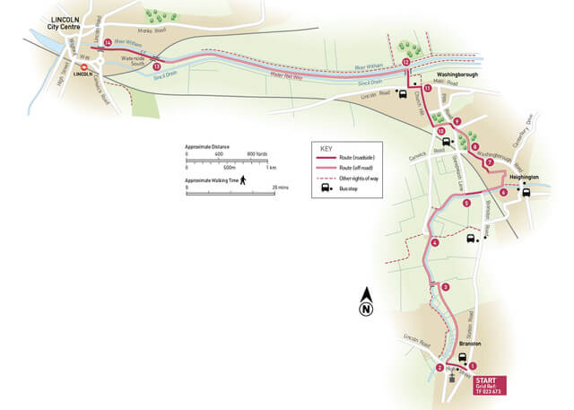
- 1Get off the bus on Station Road, close to the junction with the High Street. At the crossroads turn right and walk down the hill for 250m.
- 2Turn right onto Paddock Lane, a restricted byway. Follow the footpath straight ahead beside the stream for approximately 600m to the edge of the village. Continue straight ahead along the field edge.
- 3At the field corner and junction of footpaths turn left. Cross the bridge, turn right and follow the path beside the stream.
- 4At a junction of paths, in front of a house, continue straight ahead beside the stream. Cross the bridge, turn right, and follow the footpath by the stream. Follow the path to a road (ignoring a bridge on the right).
- 5Turn right and follow the roadside path and cycleway for approximately 150m to the bend. Cross the road with care and follow the footpath beside the stream towards the railway line. Walk under the railway line and turn right. Follow the path beside the stream for approximately 150m ,through part of Heighington village.
- 6Turn left onto a public byway. At the junction with a tarmac path turn right and then after approximately 15m turn left to walk beside a brick building, follow the path across a driveway and then straight ahead between hedges and behind some houses. At a junction with a road turn right.
- 7At the end of the road and at a T-junction turn left and follow the roadside path for approximately 175m. You can catch a bus here to return to Lincoln.
- 8Turn right onto a public footpath through an area of woodland, to a road and turn left. You can catch a bus here to return to Lincoln.
- 9At the T-junction turn right. Follow the roadside path for approximately 25m. Turn left onto a public footpath and follow it beside the woodland edge to some steps and a road.
- 10Turn right and follow the roadside path for approximately 500m to the junction with Lincoln Road.
- 11Turn left and after approximately 150m turn right onto Ferry Lane. Cross the bridge and Sincil Drain to the Water Rail Way.
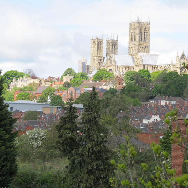
- 12Turn left and follow the Water Rail Way into Lincoln. Follow the Water Rail Way for approximately 1.75 miles (2.8 kilometres) to the edge of a car park.
- 13Follow the tarmac path along the edge of the car park and next to the river. Walk in front of the buildings to join a tarmac path beside the river and along Waterside South. Walk past Stamp End lock.
- 14At the dual carriageway turn right, cross the river, and use the pedestrian crossing to cross the dual carriageway. and continue straight ahead along St Swthins Square to return to the city centre.