


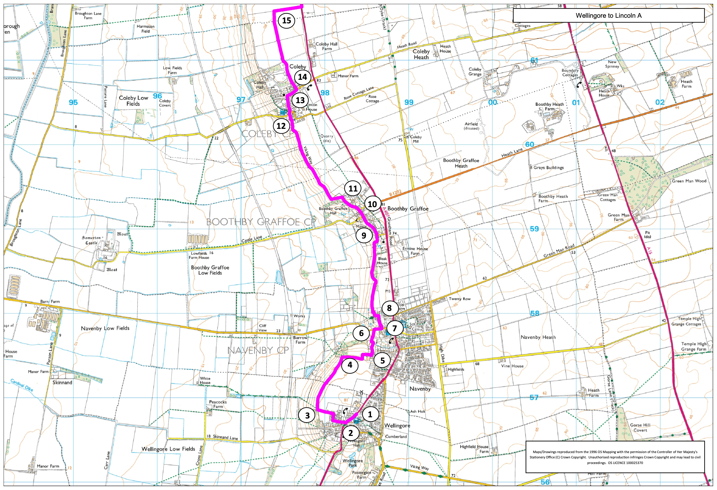
- 1Get off the bus at the old cross in Wellingore. Walk south alongside the main road for approximately 150m.
- 2Turn right onto West Street and then right onto Memorial Hall Drive. Turn left in front of the hall and walk straight across the playing field and then a field.
- 3At the hedge and fingerpost turn right. Continue walking straight ahead along the top of the scarp for approximately 700m.
- 4At the edge of a wooded area turn right and follow the field edge to join a lane. Continue along the lane for approximately 30m.
- 5Turn left along a restricted byway (The Smoots). After 200m turn right along a public footpath and after 50m turn right and then almost immediately left heading towards Navenby church.
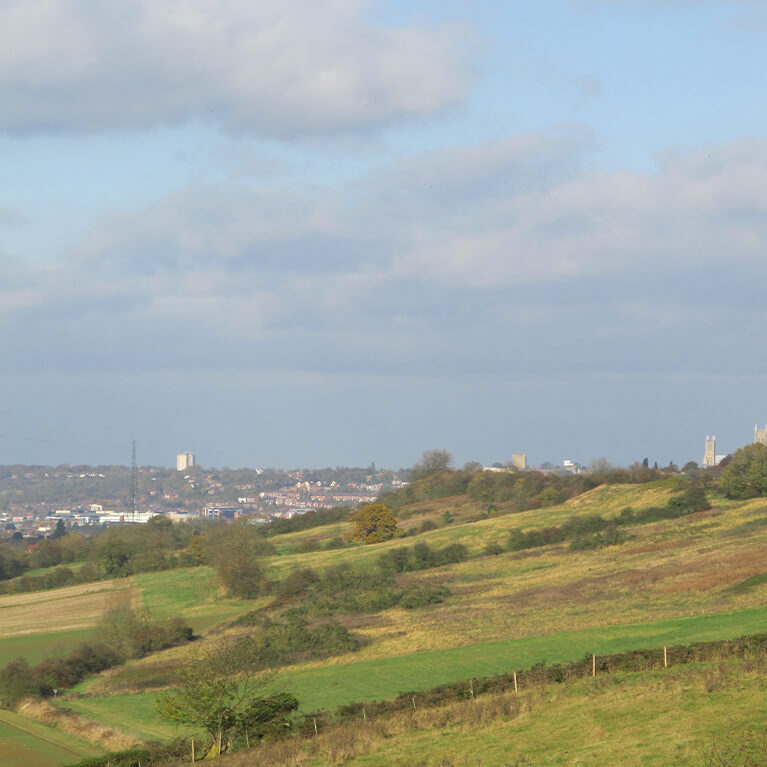
- 6At the road turn right and walk past the church, To visit Navenby village with its shops, cafes and pubs or to catch the bus continue straight on.
- 7To continue the walk turn left along the path that runs along the end of the church (Cat Walk).
- 8At the road turn left and after approximately 50m turn right onto a public footpath. Follow the path into Boothby Graffoe.
- 9Walk straight ahead through the village.
- 10Where Main Street bends to the right walk straight ahead along Far End.
- 11Where the road ends enter the field and bear left to a gate in the far corner of the field. Go through the gate and turn right. Follow the path into Coleby.
- 12At a junction of footpaths turn left. At the road walk straight ahead, past the pub, and follow the road.
- 13At the crossroads by the church turn right onto Rectory Road. To catch the bus back to Lincoln walk to the end of the road to the A607.
- 14After approximately 140m turn left onto a public footpath. Follow the path straight ahead beside the wood and then hedge.
- 15At the end of the hedge turn right along the edge of a field to the road. Turn left and follow the roadside path to the traffic lights. You can catch a bus from here back to Lincoln.
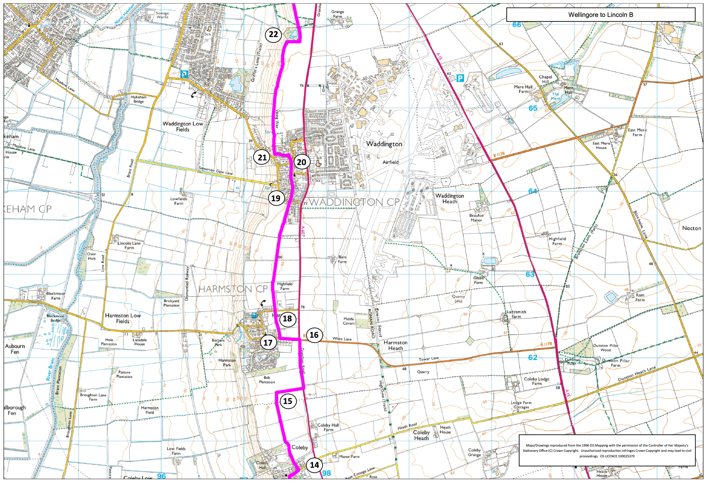
- 17Turn right onto a public footpath, opposite Harmston Park Avenue. Walk across two fields to a road.
- 18Cross the road and walk straight ahead along a public footpath. Walk past an old windmill and into Waddington. Follow the path in front of some houses to a crossroads.
- 19Cross the road and walk straight ahead along High Street past the church and pub.
- 20At the junction walk straight on along Moxons Lane. You can turn right here to the A607 to catch a bus back to Lincoln.
- 21At the T-junction turn left. Where the road bends to the left turn right onto a public footpath. Continue along the path for one mile (1.5 kilometres).
- 22Follow the path to the right, around the field edge, and then left into a wooded area. Follow the path ahead to continue along the edge of the scarp. The path will drop down the scarp behind some houses before rising to the top again.
- 23At a junction of paths and steps bear left down the steps and follow the path downhill and to the right, to a bridge.
- 24Cross the bridge, turn left, and follow the track downhill to a junction of paths.
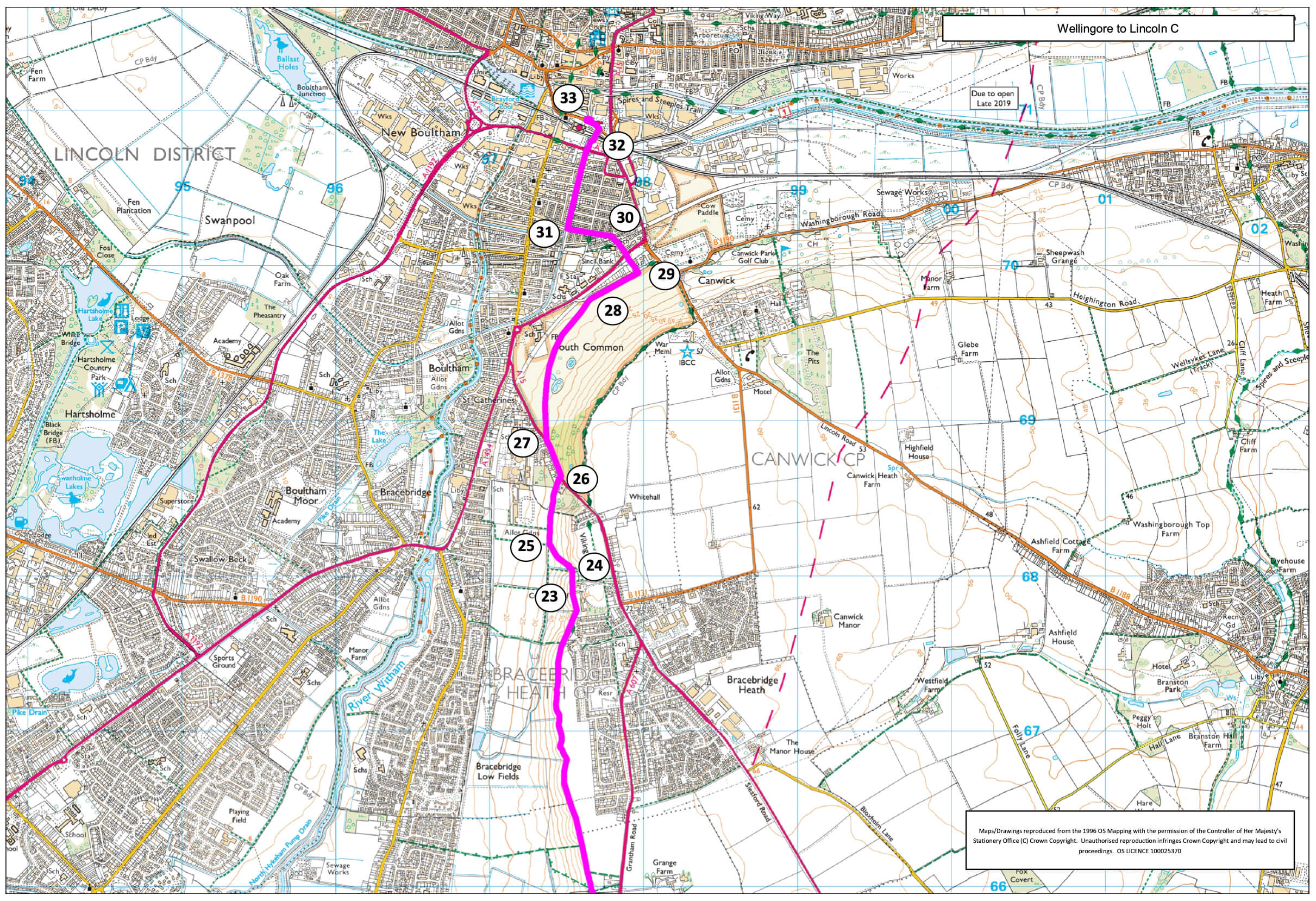
- 25Turn right and follow the path along the bottom of the field. Walk straight on through a small wooded area, past an old brick works chimney to a road.
- 26Turn left and follow the roadside path downhill past the entrance to Cross o Cliff orchard and the entrance to the school.
- 27Cross the road using the pedestrian crossing. Continue downhill for a short distance before turning right onto South Common. Bear left and follow a route across the common heading towards the cathedral. When the cathedral goes out of view keep walking along the bottom edge of the common until you are walking parallel to a row of houses facing the common.
- 28Leave the common by any of the gates and continue to walk in the same direction but beside the road.
- 29Turn left onto a path between two houses (number 75 and 76). Cross the busy road using the pedestrian crossing and turn right and immediately left. Walk straight ahead, crossing two roads, to join Scorer Street.
- 30Turn left, and walk along Scorer Street to its junction with Sincil Bank.
- 31Turn right along Sincil Bank and walk to its end. Continue straight ahead along the path/cycleway.
- 32Turn right and use the bridge to cross the railway lines.
- 33Turn left and cross the road at the pedestrian crossing. Turn right and then left along Sincil Street to return to the city centre.